

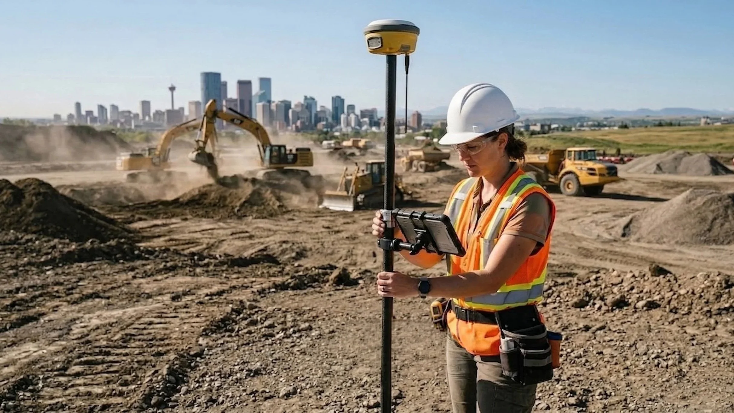
The Future of Land Development: Why Reality Capture is No Longer "Optional"
Reality capture is no longer a luxury—it’s a necessity. From "always-on" site monitoring to AI-driven analysis, discover the trends shaping the future of land development and geomatics.
From Point Cloud to Practical Data: Inside the Ortho Maps Workflow
A raw point cloud is just millions of "dumb" dots. Handing that to an engineer is a recipe for disaster. Discover the Ortho Maps geomatics workflow: from rigorous 3TM survey control and noise classification to extracting intelligent geometry at true ground scale. We do the heavy lifting so your design team doesn't have to.
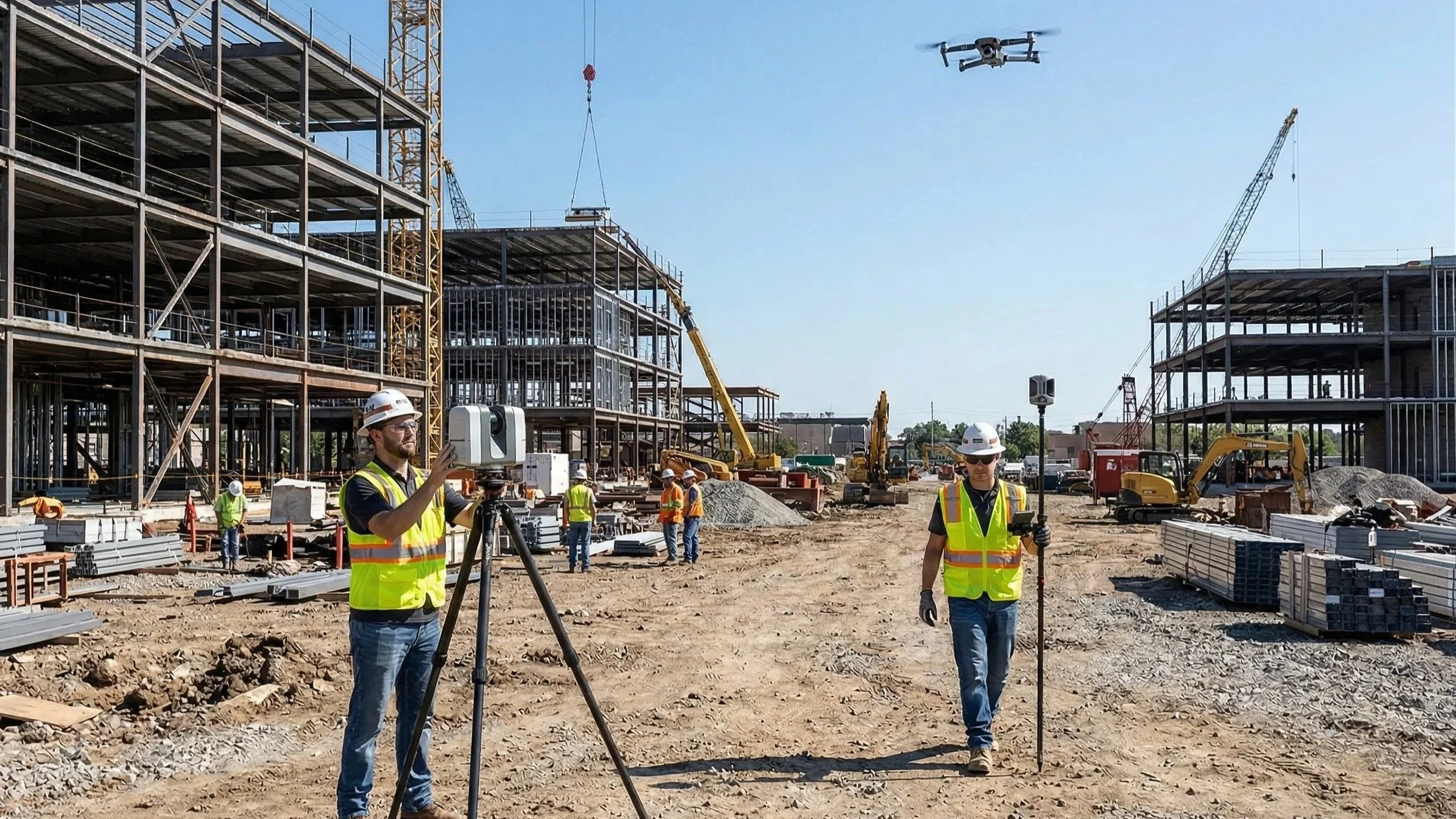
Drones in the Sky, Lasers on the Ground: How We Capture Reality at Ortho Maps
Discover the Ortho Maps approach to reality capture. We explain why combining the broad, photorealistic context of aerial drone photogrammetry with the hyper-accurate, structural detail of ground-based terrestrial LiDAR creates the perfect digital twin for your projects.
A Common Visual Language: Driving Smarter Project Delivery with Ortho Maps
At Ortho Maps, we don’t just capture data — we deliver spatial intelligence. Explore how our integrated geomatics solutions bring stakeholders together and drive smarter project delivery from planning to turnover.
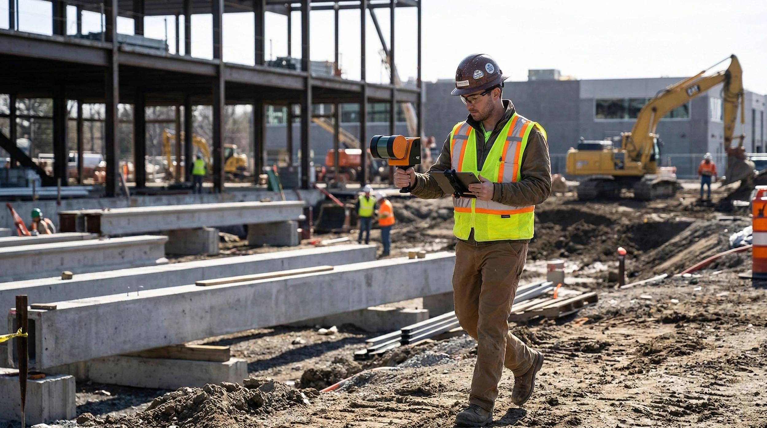
Beyond the Design Model: Terrestrial SLAM vs. 360° Capture in Capital Projects
Explore the critical differences between Terrestrial SLAM and 360° Capture. This post breaks down when to prioritize engineering-grade LiDAR measurements versus high-speed visual documentation to keep your capital projects on track and under budget.
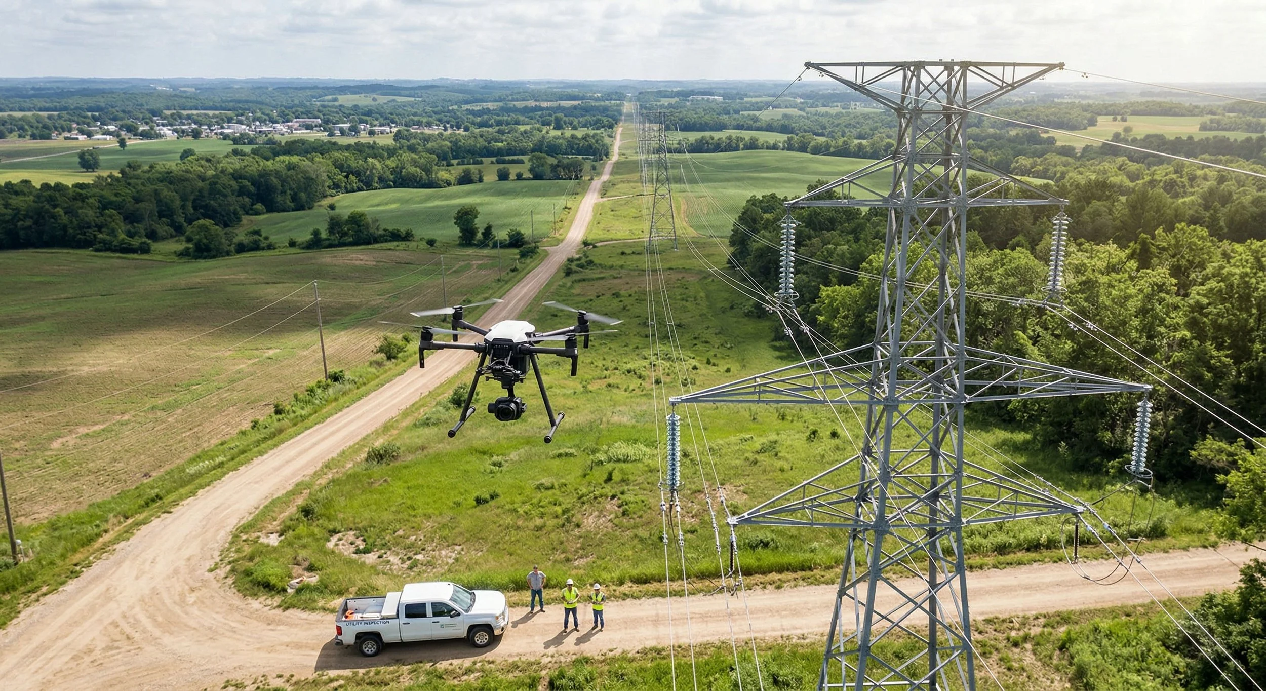
Beyond the Ground View: Modernizing Infrastructure Oversight with Aerial Asset Inspection
In the complex world of AEC and capital project development, traditional methods of inspecting assets and monitoring sites are being challenged by safety concerns and tight timelines. Learn how these technologies are providing the data needed to manage projects more effectively.
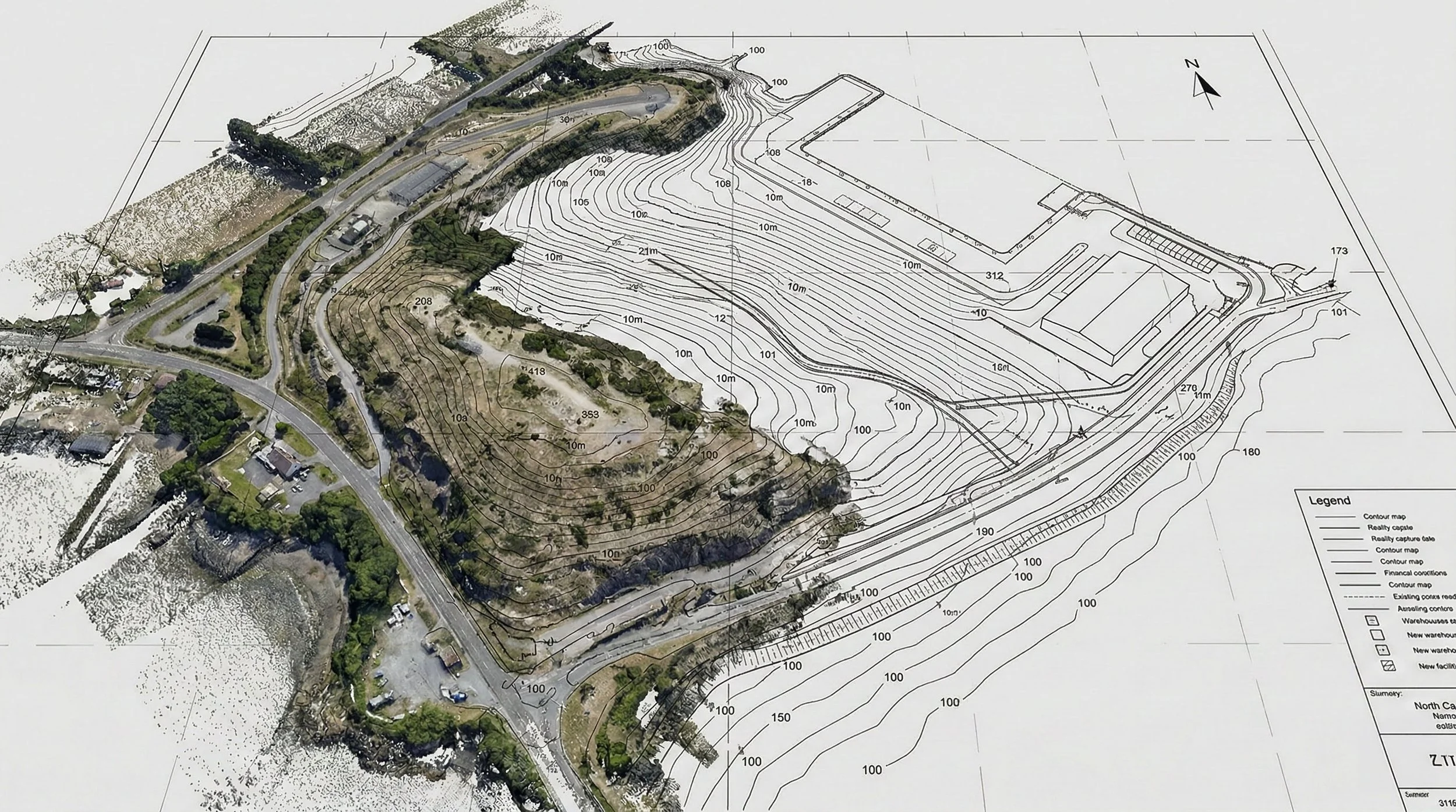
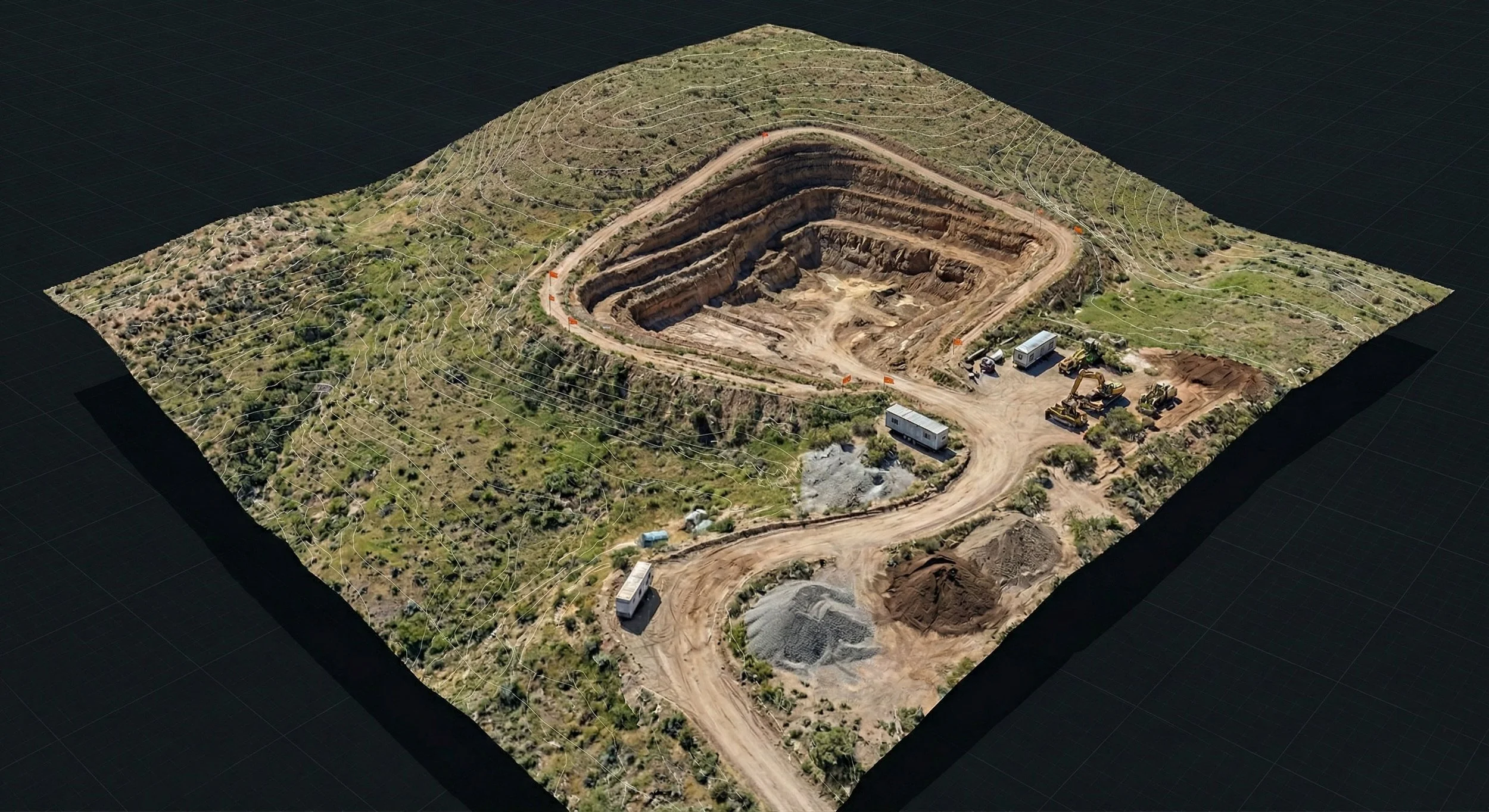
Beyond the Surface: Understanding Topography Analysis in Capital Projects
Before construction begins, understanding the ground truth is essential. Topography analysis, or mapping, provides the critical vertical data defining a site's terrain. Learn how this data is captured, analyzed for factors like slope and water flow, and why it is the bedrock of risk mitigation in AEC and capital project development.
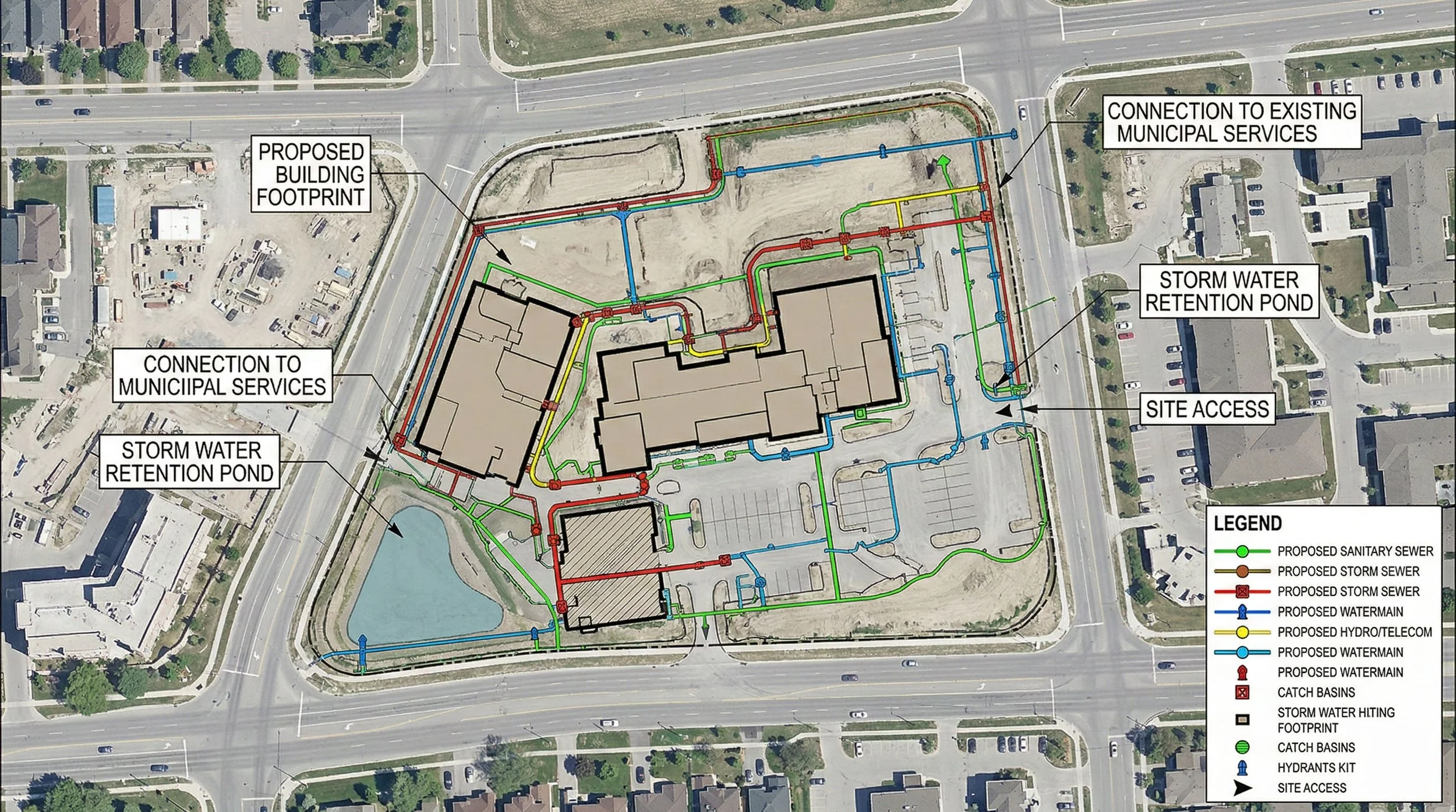
Beyond the Lines: Cartography and GIS in Capital Projects
Capital projects are complex puzzles where every piece has a location. This post breaks down the crucial difference between Cartography (the art of communication) and GIS Analysis (the science of data), and how combining them unlocks smarter decision-making in AEC and development.
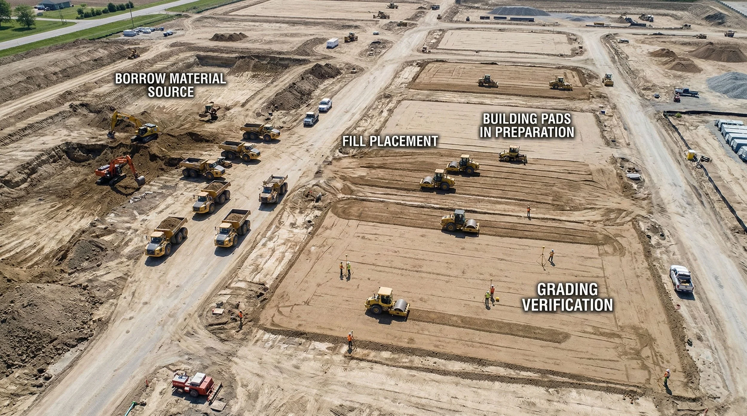
Beyond the Dirt: Understanding Volumetric Analysis in Capital Projects
Moving earth is one of the biggest costs in construction projects. Discover how modern volumetric analysis — using drone data for stockpile measurements, cut/fill calculations, and QA/QC — is replacing outdated estimation methods with precise, verifiable data that mitigates risk and improves project budgeting.
Beyond the Blueprint: Understanding Digital Twinning and 3D Virtualization in Capital Projects
Stop thinking of Digital Twins as complex IT projects. In AEC, a Digital Twin is your project’s digital mirror — a highly accurate 3D virtualization that streamlines planning, communication, and construction. Discover how Ortho Maps uses reality capture to bridge the gap between the blueprint and the build.
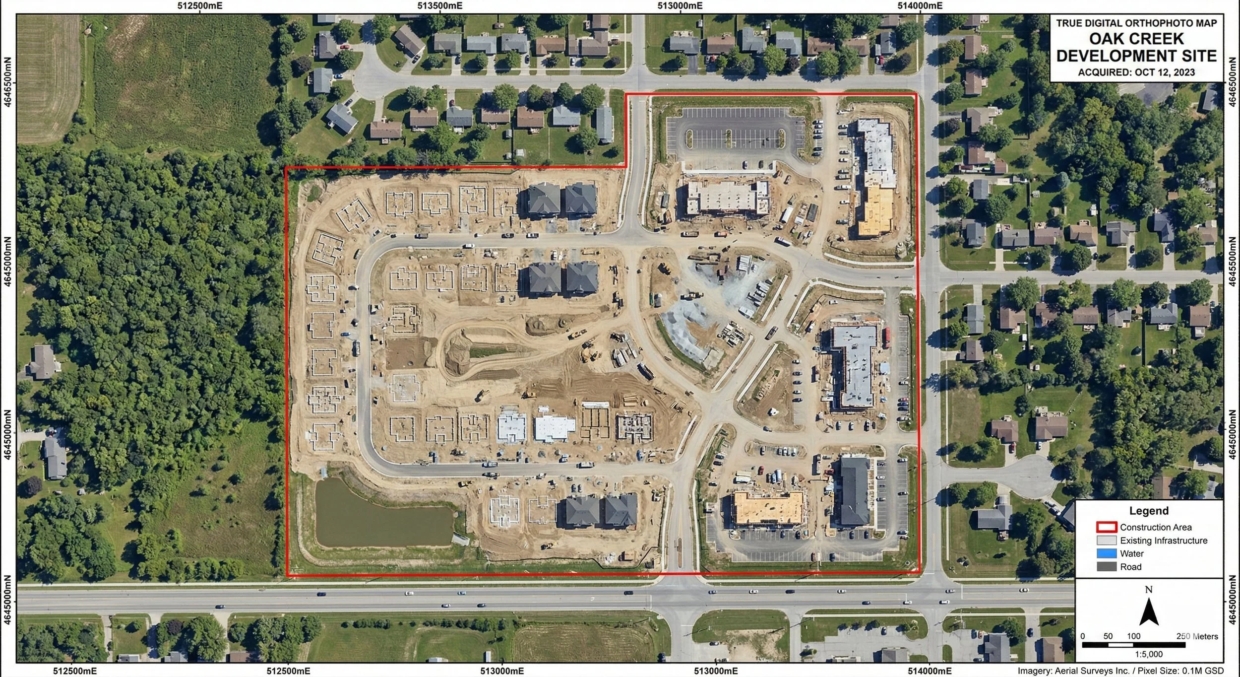
Beyond the Aerial Photo: Understanding Orthographic Mapping in Capital Projects
Before construction begins, understanding the ground truth is essential. Orthophoto mapping provides the critical, distortion-free visual data defining a site's exact layout. Learn how this imagery is captured, orthorectified for precise measurements, and why it is the bedrock of risk mitigation in AEC and capital project development.