
Beyond the Lines: Cartography and GIS in Capital Projects
Capital project development — whether it’s infrastructure, large-scale commercial builds, or resource development — is essentially a massive, complex puzzle. Every piece of that puzzle, from environmental constraints to utility access, has a location.
When stakeholders look at a project, they often just want to see "the map." But a truly effective map isn't just a drawing; it is the final output of rigorous data analysis combined with intentional design.
At Ortho Maps, we find that many clients in the AEC (Architecture, Engineering, and Construction) sectors know they need "mapping," but perhaps aren't fully aware of the distinction — and the combined power — of GIS & Geospatial Analysis. Understanding the difference is key to unlocking better decision-making for your projects.
Here is a breakdown of what these disciplines are and how they drive success in capital development.
Cartography: The Art of Clarity
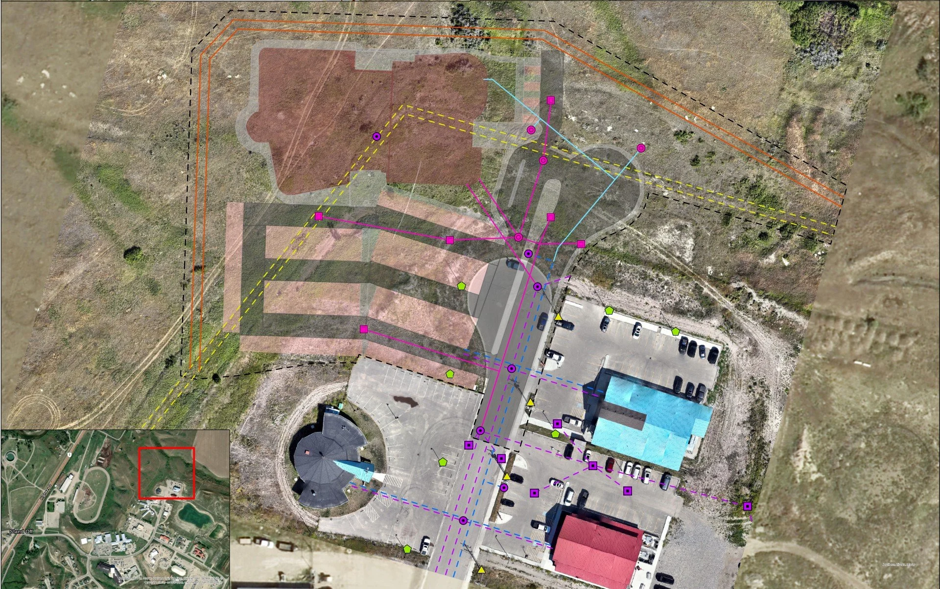
A development site servicing plan laid out on an up-to-date aerial orthophoto, more clearly visualizing the building footprint and civil servicing proposed.
If you have ever looked at a confusing engineering diagram and struggled to understand what you were seeing, you have experienced a lack of cartography.
Cartography is the art and science of mapmaking. It is focused on communication. A cartographer takes complex spatial data and translates it into a visual format that the human brain can quickly understand. It involves decisions about color palettes, symbology, typography, and hierarchy — ensuring the most important information pops while the context remains clear.
In the context of AEC, good cartography means:
Stakeholder Engagement: Presenting complex site plans to the public or investors in a way that is approachable and easy to digest, rather than intimidating.
Regulatory Submissions: Creating clear, compliant maps for permits that reduce friction with regulatory bodies.
A well-designed map builds trust. It shows you understand the landscape intimately. Learn more about how Ortho Maps can enhance your site planning with Cartographic Mapping.
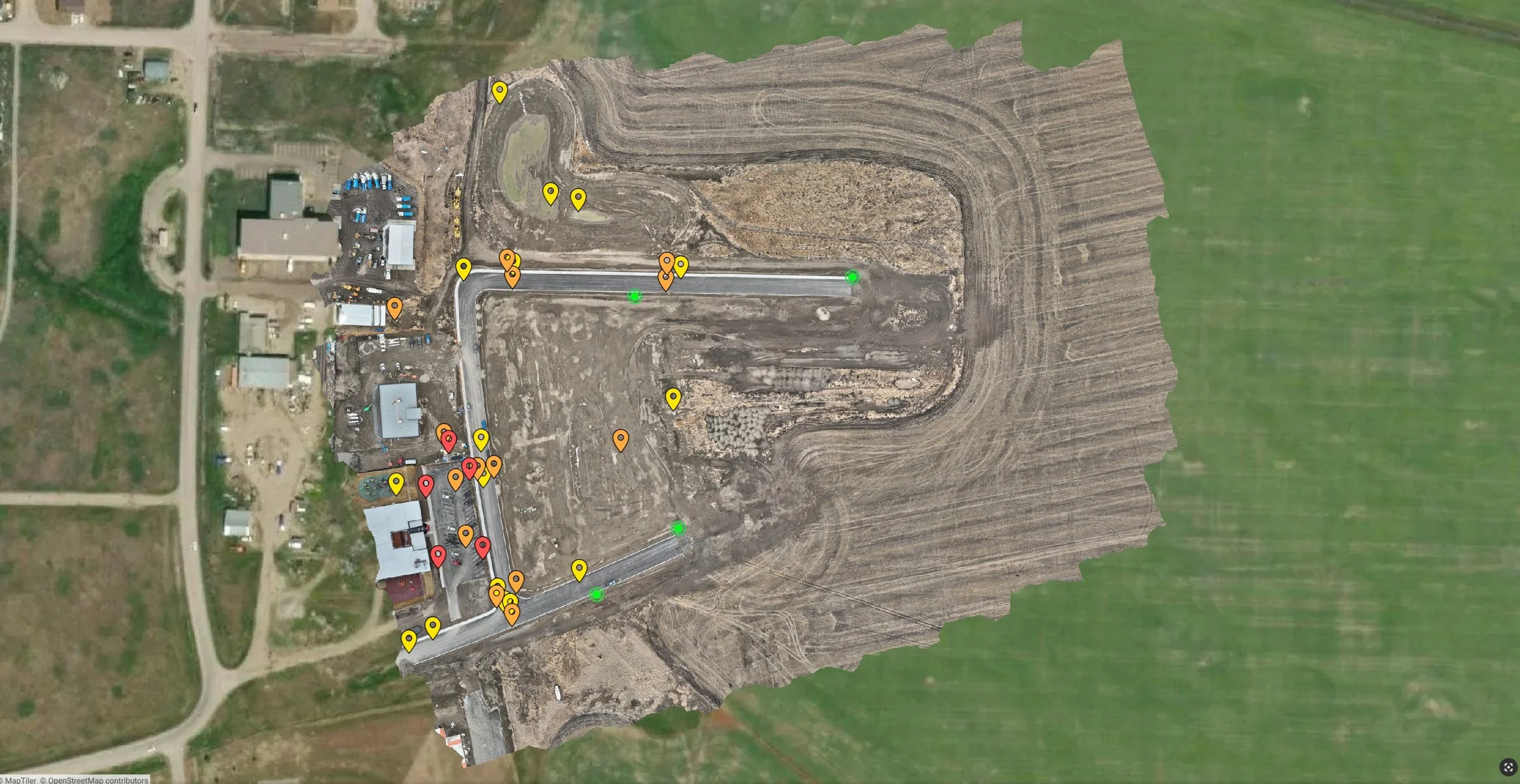
A orthographic map of a subdivision with deep utility features annotated as interactive and inspectable click-points.
GIS Analysis: The Science of "Where"
If cartography is the tip of the iceberg that everyone sees, Geographic Information Systems (GIS) is the massive structure beneath the water.
GIS is not just software; it is a framework for gathering, managing, and analyzing data. It allows us to layer seemingly unrelated datasets on top of one another to find relationships, patterns, and trends based on location.
Instead of just asking, "Where is the site?", GIS analysis allows us to ask complex questions like: "Where are the areas on this site with slopes greater than 15%, that are also within 100 meters of a wetland, and have poor soil drainage?"
In capital projects, GIS analysis is the engine room for mitigating risk.
The Power Duo in Capital Project Development
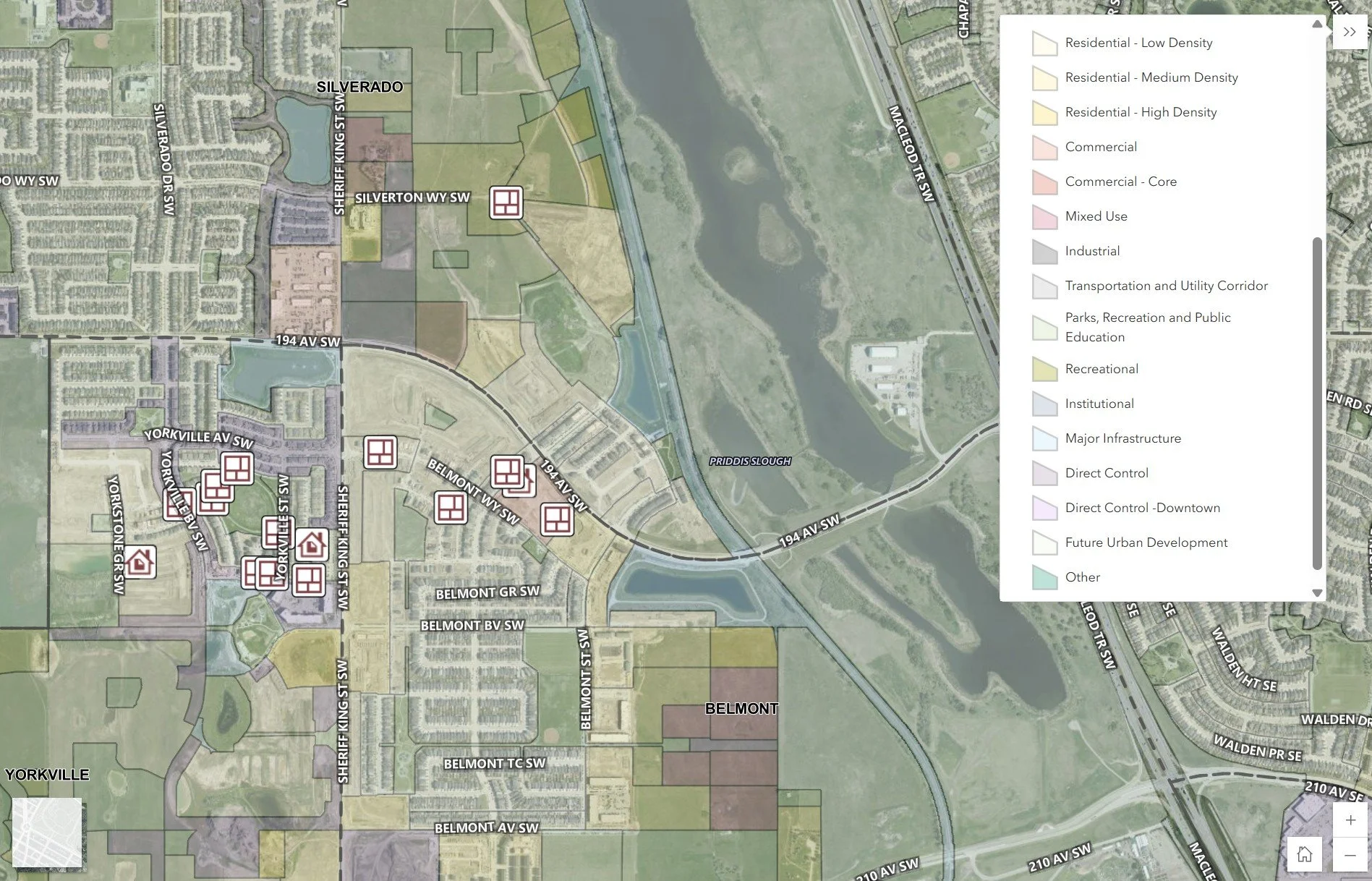
A map visually identifying land-use classes across a broader set of subdivisions.
When you combine strong GIS analysis (the science) with skilled cartography (the art), you get a powerful decision-support tool.
For AEC firms and developers, integrating these disciplines early in the project lifecycle offers immense value:
Smarter Site Selection: We can use GIS to rank dozens of potential sites against criteria like transportation access, zoning regulations, and environmental impact, rapidly narrowing down the best options.
Constraints Mapping & Risk Mitigation: By layering data regarding floodplains, protected species habitats, and existing utility easements, we identify expensive "showstoppers" before significant capital is spent on design.
Logistics and Access Planning: GIS can model the best routes for heavy haul transport to a construction site or analyze cut-and-fill volumes to optimize earthworks.
Progress Tracking: Using drone imagery alongside GIS allows for precise tracking of construction progress against the original design model.
Moving Forward
A map is more than a deliverable to be filed away. It is a dynamic tool that should inform every stage of a capital project’s lifecycle. By leveraging both the analytical power of GIS and the communicative clarity of cartography, you turn raw data into actionable project intelligence. Start a conversation with us to see how our GIS cartography and analysis can support your project’s goals.