
Beyond the Blueprint: Understanding Digital Twinning and 3D Virtualization in Capital Projects
In the world of Architecture, Engineering, and Construction (AEC), the gap between what is on a blueprint and what is happening on-site has historically been a source of risk. Today, that gap is closing.
At Ortho Maps, we view "Digital Twinning" and "3D Virtualization" not as abstract tech concepts, but as practical, visual tools that provide a digital mirror of your physical project. Whether you call it a 3D model or a digital twin, the goal remains the same: creating an accessible, accurate, and measurable version of your site that lives on your screen.
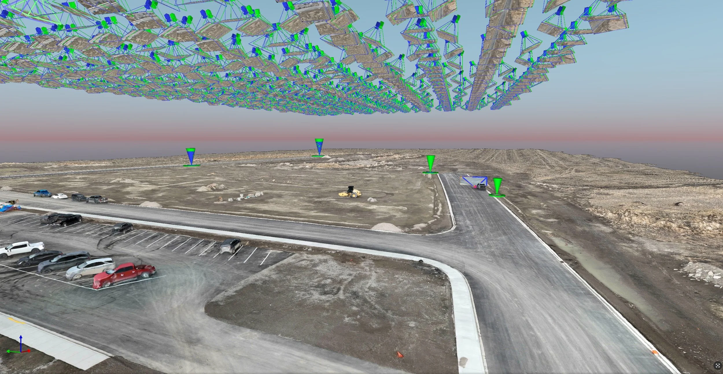
A 3D mesh model of a pre-construction subdivision plot.
Beyond the Buzzwords: Twinning as a Tool
In many technical circles, "Digital Twin" implies a complex web of live sensors and building management systems (BMS). However, for capital project development, a digital twin is often much more straightforward — and much more useful.
It is a 3D Virtualization of your asset. By using reality capture — aerial photogrammetry and terrestrial scanning — we create a digital replica that mirrors the site’s current state. This isn’t just a "pretty picture"; it’s an environment where every pixel represents real-world coordinates and dimensions.
For developers and project managers, the value of having a 3D virtualized twin of a project lies in data continuity. Instead of disparate sets of photos and 2D notes, a 3D model serves as a "single source of truth."
Learn more about 3D Modeling & Digital Twins at Ortho Maps.
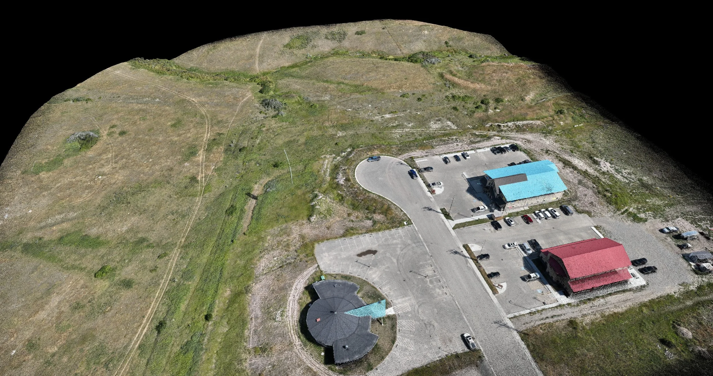
Professional reality capture twins can be displayed anywhere for site analysis, bridging the gap between field teams and project stakeholders.
Why AEC Professionals are Moving to 3D Environments
1. Precision Planning and Feasibility
During the early stages of a capital project, the digital twin allows for precise terrain analysis and site planning. You can walk the site virtually, measure distances, and calculate volumes without ever leaving the office. This level of virtualization ensures that the design phase is built on the reality of the ground, not an approximation.
2. Visualizing Progress in Real-Time
As a project moves into construction, the 3D model becomes a living document. By capturing the site at regular intervals, we create a chronological "twin" of the build. This allows stakeholders to overlay design files against actual progress, identifying deviations early and keeping contractors accountable.
3. Streamlined Stakeholder Communication
A 3D virtualized environment is inherently more intuitive than a flat drawing. Whether you are presenting to investors or coordinating with sub-contractors, a digital twin provides a common visual language. It simplifies complex spatial issues and makes project updates digestible for everyone involved, regardless of their technical background.
Practicality Over Complexity
You don't need a million-dollar BMS setup to benefit from digital twinning. For most capital projects, the most valuable "twin" is simply a highly accurate, easily accessible 3D model of the site. It’s about having the right information, in the right dimension, at the right time.
At Ortho Maps, we specialize in creating these digital mirrors, helping you de-risk your development and bring your project into focus.
To learn more about how reality capture forms the foundation of these digital strategies, explore our approach at Ortho Maps, or contact us to discuss your site’s needs.