gisbimflythrough.jpg

Reality Capture • Geomatics

Precision spatial data for the modern AEC workflow. Driving smarter project delivery.

The Architecture of Certainty.

A Common Visual Language

Ortho Maps synchronizes stakeholders through a unified digital perspective. By establishing high-fidelity visual baselines, we provide the single source of truth required to eliminate coordination gaps and costly delays.

Strategic Project Context

Rooted in development management, Ortho Maps provides more than data. We deliver the critical context necessary for owners and engineers to make informed decisions and drive project success.

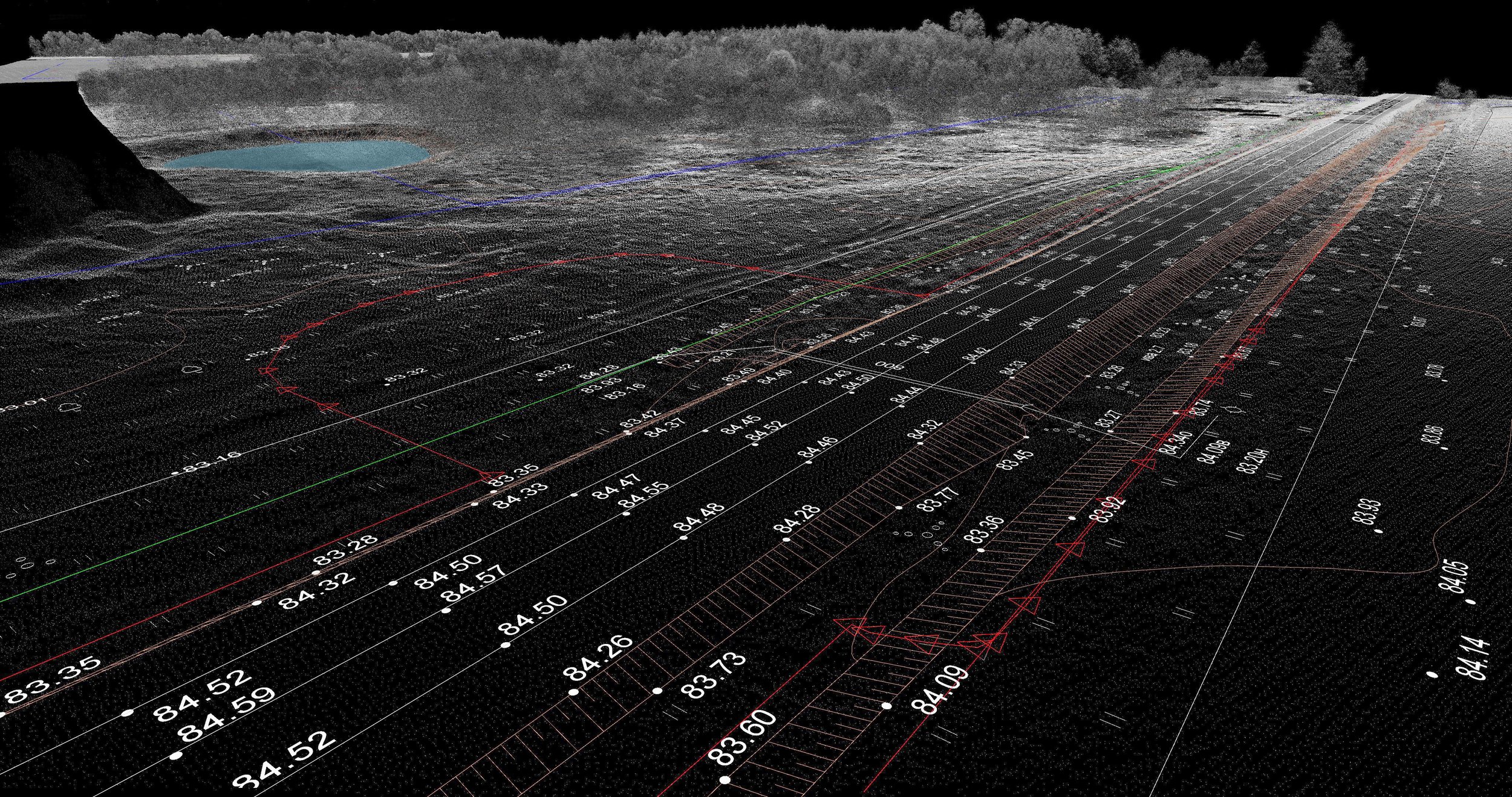
Engineering-Grade Precision

We deliver datasets to rigorous technical specifications. From aerial photogrammetry to terrestrial SLAM, Ortho Maps provides the high-fidelity intelligence required to maintain quality and mitigate risk.

The Perspective to Build Smarter.