
Beyond the Dirt: Understanding Volumetric Analysis in Capital Projects
In the high-stakes world of AEC (Architecture, Engineering, and Construction) and capital project development, moving materials — whether it’s soil, aggregate, or specialized resources — is often one of the largest budget line items. Historically, estimating these volumes relied on manual ground staking methods, estimation based on truck counts, or sometimes, educated guesses.
Today, geospatial technology allows us to move from estimating to calculating.
This ‘snapshot’ of current grade will serve as the base-plane that future reality capture will be compared against as site-grading progresses.
Volumetric analysis, derived from high-accuracy drone photogrammetry data, transforms physical sites into measurable 3D digital models. For stakeholders in capital projects, this means replacing assumptions with verifiable data.
Here is a breakdown of what volumetric analysis is and how it is applied in modern construction workflows.
What is Volumetric Analysis?
At its core, volumetric analysis involves creating a highly accurate Digital Surface Model (DSM) or Digital Terrain Model (DTM) of a project site. By establishing a "base plane" (the ground level before activity) and comparing it to the current surface, special software can calculate the exact volume of material sitting above that plane or the empty space below it.
Because these measurements are based on millions of data points captured aerially, rather than a few dozen points captured manually on the ground, the resulting data is significantly more representative of the actual site conditions.
Key Applications in AEC
While the technology is complex, its applications on a job site are practical and immediately valuable.
Volumetric analysis of a topsoil stockpile to calculate precise volume for inventory tracking and site material management.
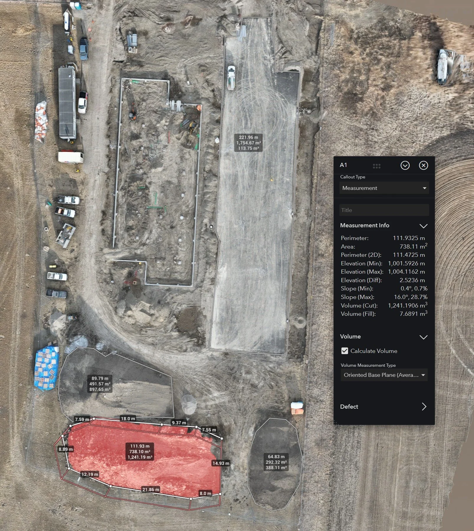
1. Stockpile Management and Inventory
For quarries, mines, and large construction sites, knowing exactly how much inventory is on hand is crucial for financial reporting and supply chain management.
Traditional methods often involved sending staff to safely climb stockpiles with GNSS poles — a slow and sometimes hazardous task. Aerial volumetric analysis allows for rapid, safe, and frequent measurements of stockpiles, providing accurate data for monthly audits and inventory valuations.
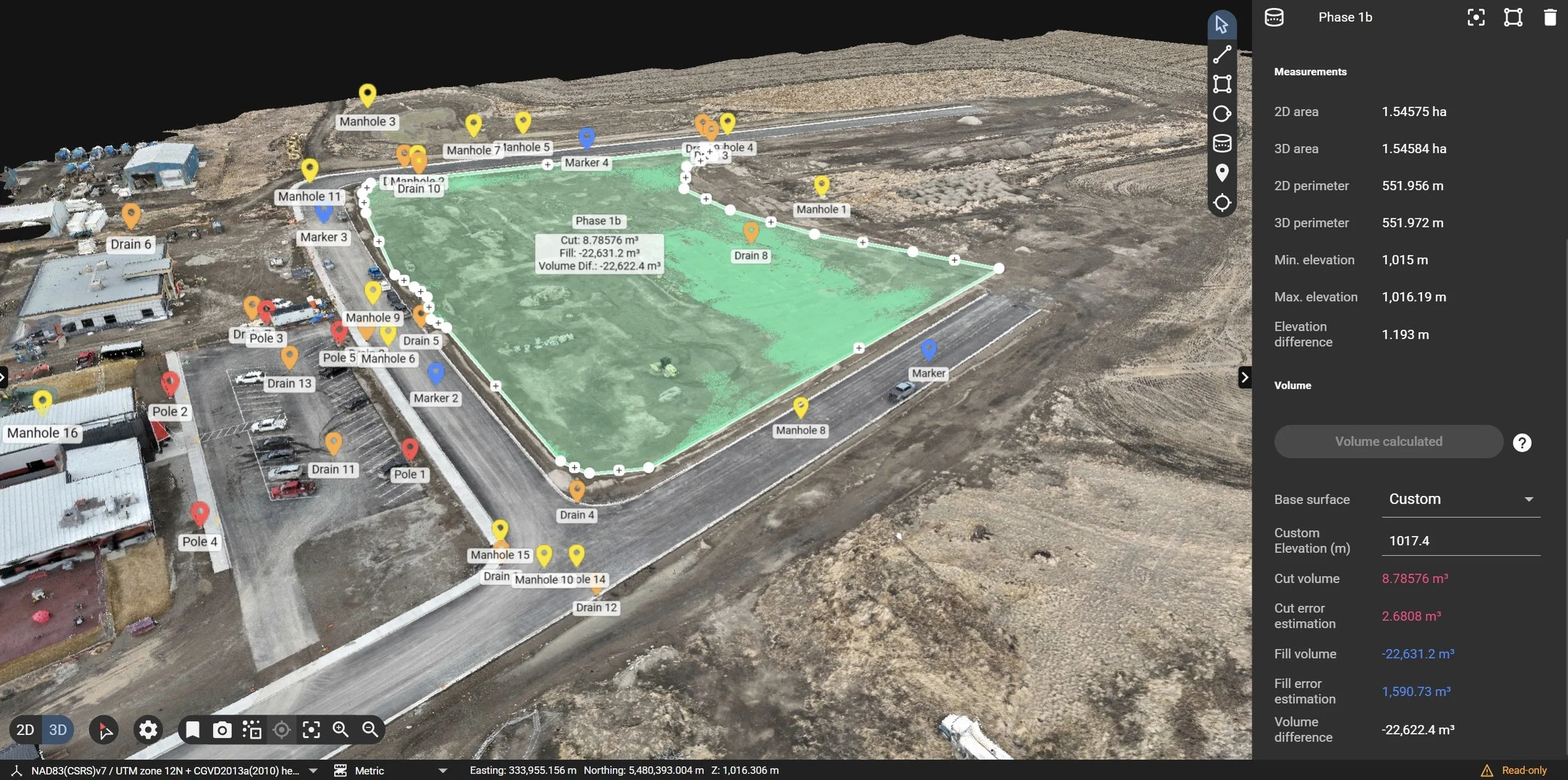
2. Cut and Fill Analysis
Before major construction begins, the site must be graded to the design specifications. "Cut" refers to removing earth from high spots, and "fill" refers to adding earth to low spots.
By comparing a pre-construction drone map against the proposed civil design model, we can generate a precise Cut/Fill heat map. This tells site managers exactly how much dirt needs to move and where it needs to go, allowing for more accurate bidding on earthworks and better management of subcontractors.
3. QA/QC and Progress Verification
How do you know if the excavation is proceeding according to the plan? Volumetric analysis isn't just for pre-planning; it is a vital tool for ongoing Quality Assurance/Quality Control.
By flying a site regularly, we can compare "as-built" conditions against the design intent. For example, we can verify if a foundation pit has been dug to the correct depth and volume before concrete trucks arrive, preventing costly rework later. This level of verification is integral to our Volumetric Analysis Solution.
The Value of Accurate Data
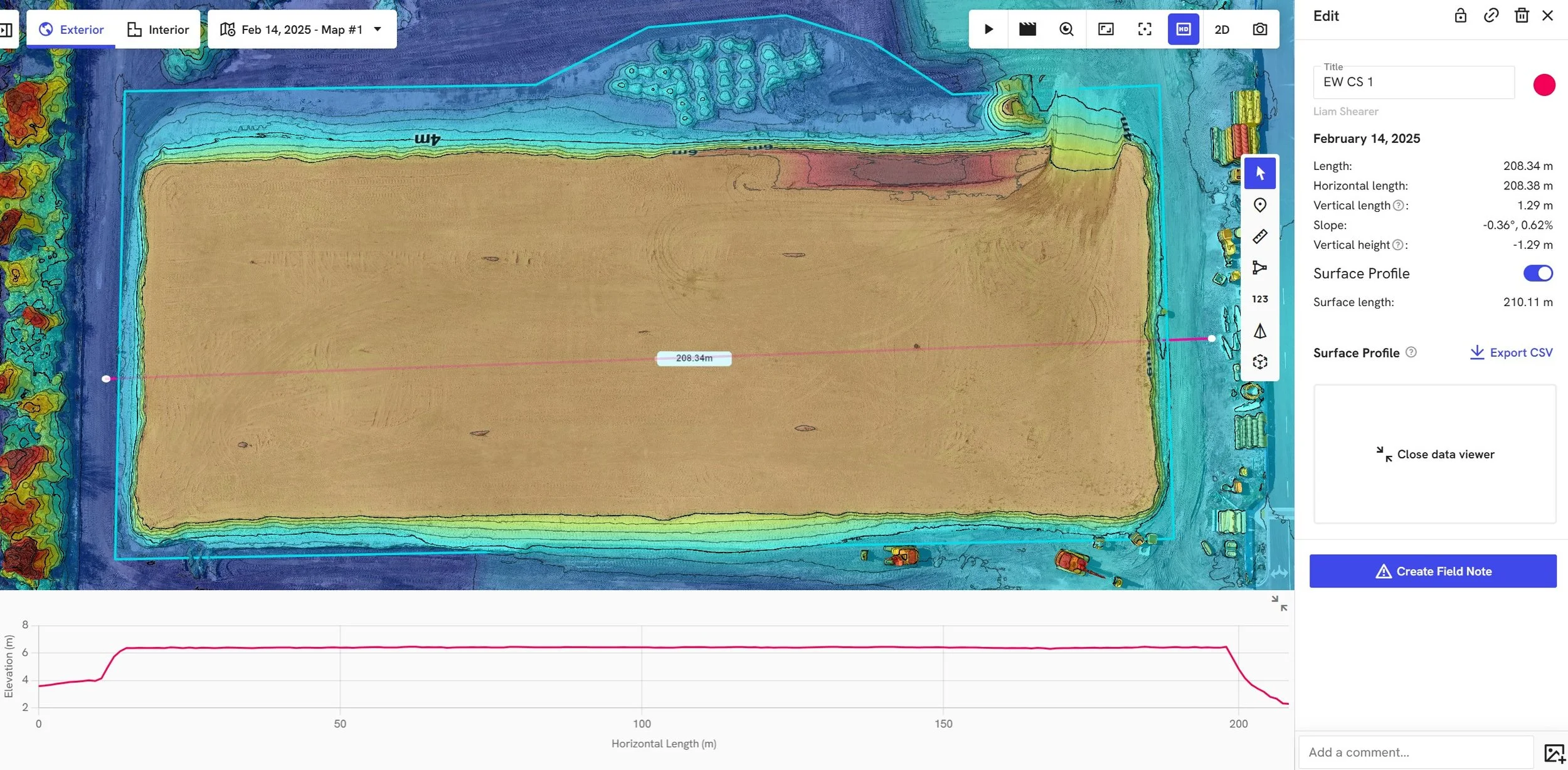
A building pad's finished volume surface profile represented as a 2D cross-section elevation graph.
In capital project development, mitigating risk is paramount. Volumetric analysis provides a source of truth that aligns stakeholders — from the site superintendent to the financial controller. It reduces disputes over quantities, ensures contractors are paid for actual work completed, and keeps project timelines on track by identifying grading issues early.
At Ortho Maps, we specialize in turning complex geospatial data into actionable insights. Volumetric reporting is just one way we help AEC professionals build with confidence.
If you are looking to integrate accurate volumetric data into your next capital project, please explore our full range of solutions or get in touch to discuss your specific site requirements.