
The Future of Land Development: Why Reality Capture is No Longer "Optional"
Relying on intermittent site visits and static 2D snapshots is no longer just slow—it's a liability. In an era of compressed schedules and razor-thin margins, spatial blind spots are where contingency budgets go to die. At Ortho Maps, we are watching the industry shift from reactive, milestone-based geomatics to continuous spatial intelligence. Reality capture is no longer an elective line item; it is the foundational infrastructure of the modern job site.
Here are the key shifts driving the architecture, engineering, and construction (AEC) sectors forward.
1. From "One-and-Done" to Iterative Progress Audits
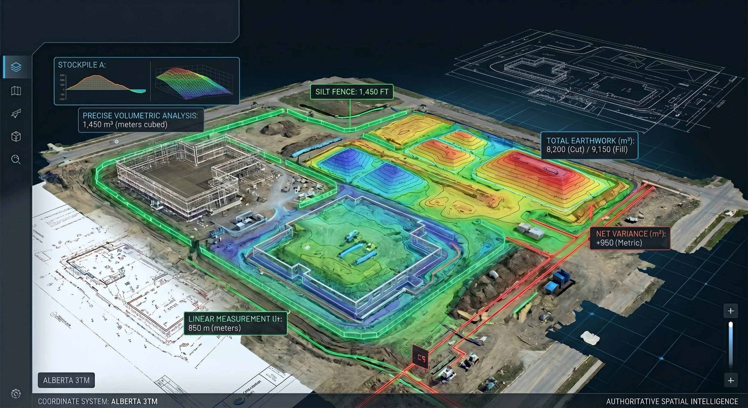
The traditional model of recording a site at the beginning and end of a project is being replaced by cyclical, automated capture. By executing routine aerial photogrammetry flights on a strict operational cadence, we provide continuous site tracking. This turns your digital twin from a static historical record into an active progress audit. Project managers can overlay design models onto weekly capture data to verify earthwork volumes and catch structural deviations before they compound into multi-million dollar reworks.
2. Forensic As-Builts as the New Handover Standard
Paper blueprints are a poor reflection of what was actually constructed. We are rapidly approaching a standard where project closeouts contractually require a high-fidelity 3D digital record. Utilizing terrestrial LiDAR to capture structural framing, concrete reinforcement, and subterranean MEP systems prior to drywall and backfill creates a permanent, unarguable asset registry. This "digital X-ray" provides bulletproof liability protection for general contractors and invaluable spatial data for lifelong facility management.
3. Machine Learning and Automated Feature Extraction
The historical bottleneck of reality capture has never been field execution; it has been the data processing timeline. Today, machine learning is dramatically accelerating data turnaround. By deploying advanced algorithms for point cloud classification segmentation, we can automatically strip out transient field noise (machinery, vehicles, crews) to isolate bare earth or specific structures. This slashes the timeline for asset vectorization, delivering clean topographic lines, structural geometry, and volumetric data to your design team in merely a day or two, rather than a week or more.
4. Direct CDE Integration and Unified Coordinates
A 3D model is only useful if it integrates seamlessly with your daily design tools. The industry is moving away from isolated file transfers and toward direct integration within Common Data Environments (CDEs). Because Ortho Maps processes all data natively within the Alberta 3TM projection and scales exports to ground truth (1:1), our deliverables sync seamlessly with open-standard IFC files, Revit, and Civil 3D models without coordinate translation errors. We ensure the office and the field are operating on the exact same spatial truth.
The Bottom Line: The competitive advantage belongs to firms that treat spatial data as a risk-management asset, not an afterthought. At Ortho Maps, we deliver the high-precision, engineering-grade frameworks that protect your margins and validate your execution.