
Beyond the Design Model: Terrestrial SLAM vs. 360° Capture in Capital Projects
In the world of capital project development, the biggest risk is often the "known unknown" — the discrepancy between the engineering models on a screen and the actual conditions on the ground.
Closing this gap requires more than just a site walk; it requires high-fidelity reality capture. While aerial drone mapping provides the essential "macro" view of a project, the interior and complex ground-level spaces require a more granular, "micro" approach.
Today, two primary terrestrial technologies are used to bridge this gap: Terrestrial SLAM (LiDAR) and 360° Photo Capture. While they may look similar in the field — often involving a technician walking the site with a handheld device — their utility, data depth, and cost-profiles vary significantly.
Engineering-Grade Precision: Terrestrial SLAM (LiDAR & RTK)
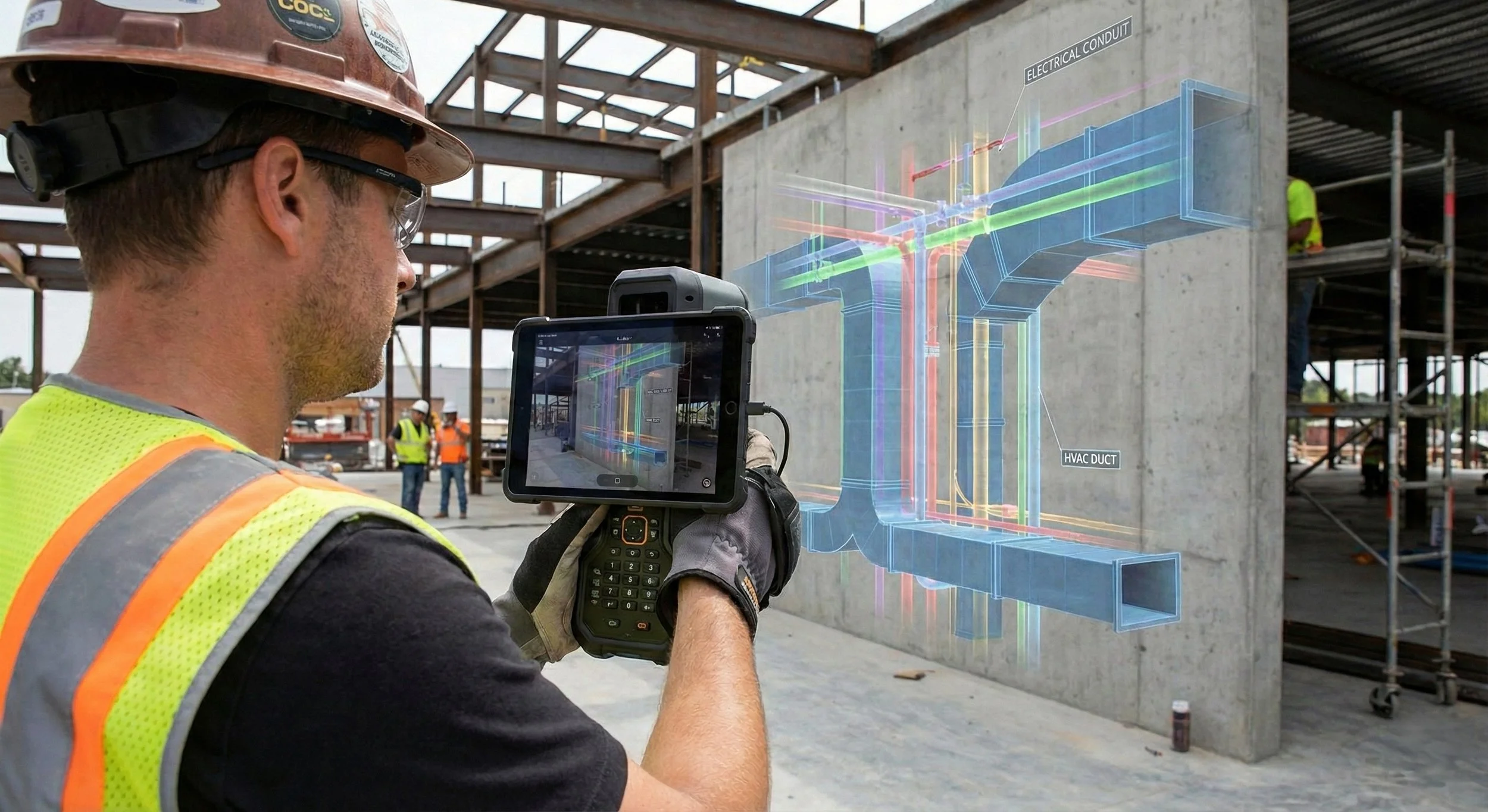
A terrestrial SLAM device being used to precisely project the designed MEP locations on an augmented reality screen.
SLAM (Simultaneous Localization and Mapping) is a sophisticated technology that allows a device to build a map of an unknown environment while simultaneously keeping track of its own location within it.
When we deploy SLAM units at Ortho Maps, we are using LiDAR (Light Detection and Ranging) sensors. These sensors emit laser pulses to create a "Point Cloud" — a 3D mathematical representation of every surface in the room or a space. By integrating RTK (Real-Time Kinematic) GNSS modules and portable screens, we can verify data quality in real-time, ensuring that the relative scan data is tied to absolute, real-world geodetic coordinates.
Key Applications in AEC:
Scan-to-BIM: Generating accurate Revit or CAD models of existing structures for renovation.
Clash Detection: Identifying where new mechanical, electrical, or plumbing (MEP) systems might conflict with existing structural elements before fabrication begins.
Deflection Analysis: Checking for floor flatness or structural shifts over time.
Rapid Visual Intelligence: 360° Photo Capture
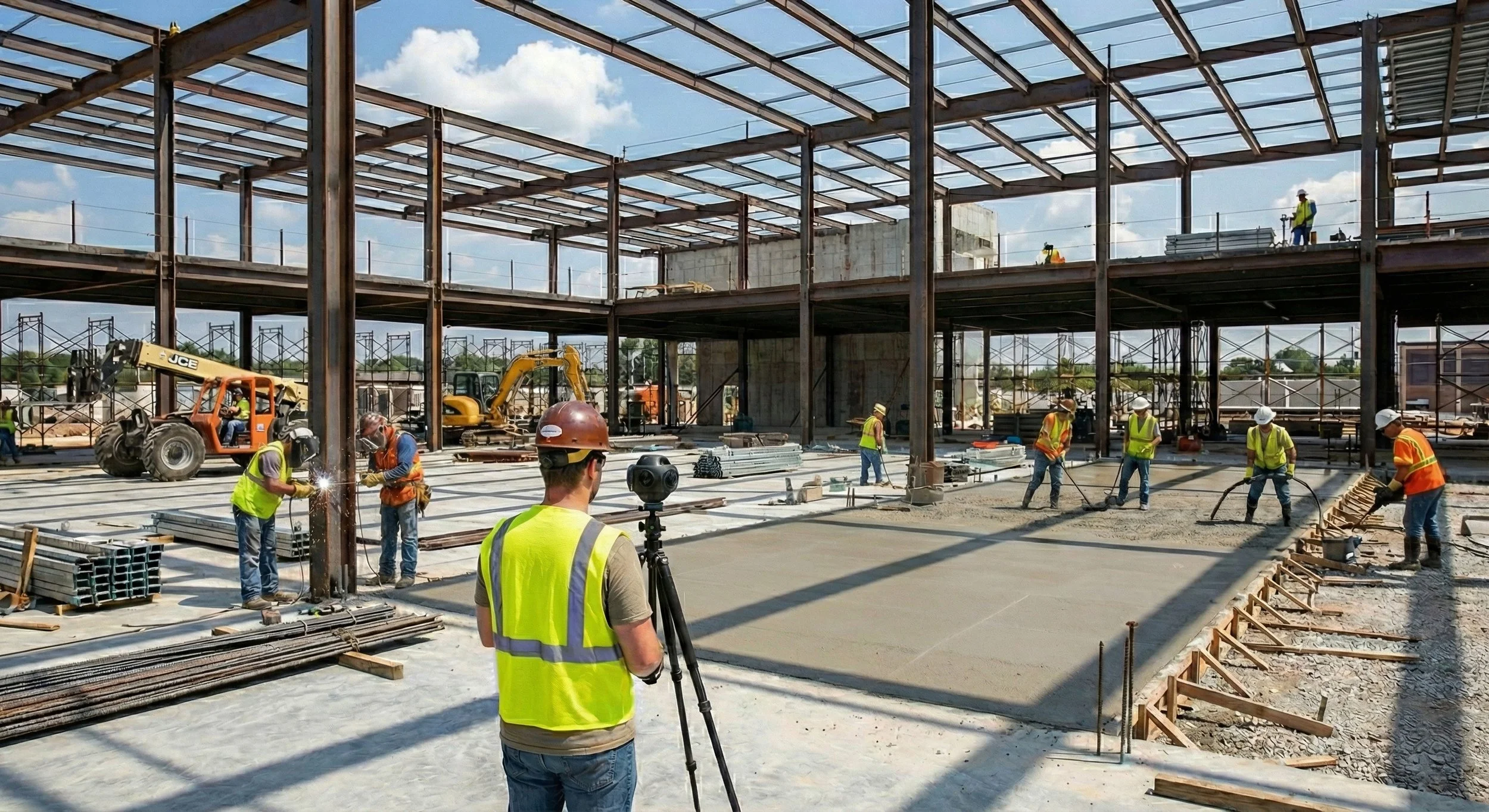
A 360° camera quickly capturing the project site as it is moved around areas.
360° capture uses high-resolution cameras to create spherical, immersive imagery. Unlike LiDAR, this is not a measurement tool; it is a documentation and communication tool.
The primary advantage here is speed and accessibility. An entire floor of a hospital or data center can be captured in a fraction of the time it takes to perform a full LiDAR scan, providing an immersive digital record of a specific moment in the construction timeline.
Key Applications in AEC:
Weekly Progress Tracking: Creating a "Google Street View" style timeline of the job site for remote stakeholders.
Virtual Site Inspections: Reducing the need for travel by allowing engineers and owners to "walk the site" from their offices.
Transparency & Accountability: Having an indisputable visual record of what was behind a wall before the drywall was hung.
Which Path for Your Project?
The choice between these two methods usually comes down to a single question: Do you need to measure it, or do you need to see it?
If you are verifying that a steel beam was placed within a relative tolerance, you need Terrestrial SLAM.
If you need to show the project owner that the electrical rough-in is 80% complete, you need 360° Capture.
At Ortho Maps, we often recommend a hybrid approach for capital projects — utilizing 360 capture for weekly updates and deploying Terrestrial SLAM at major project milestones to ensure the build remains true to the design.
Ready to bring a higher level of site intelligence to your next project? Get in touch with us to start a conversation on your project needs. You can also explore how our services can de-risk your development.