
Drones in the Sky, Lasers on the Ground: How We Capture Reality at Ortho Maps
In reality capture and geomatics, there is no single "magic button" to digitize a job site. At Ortho Maps, our clients often ask us about the technology we use to create our highly accurate 3D models and maps. The secret to our precision? We divide and conquer. We rely on Aerial Photogrammetry from the sky and Terrestrial LiDAR on the ground. Here is why we use this specific approach and what it means for your next project.
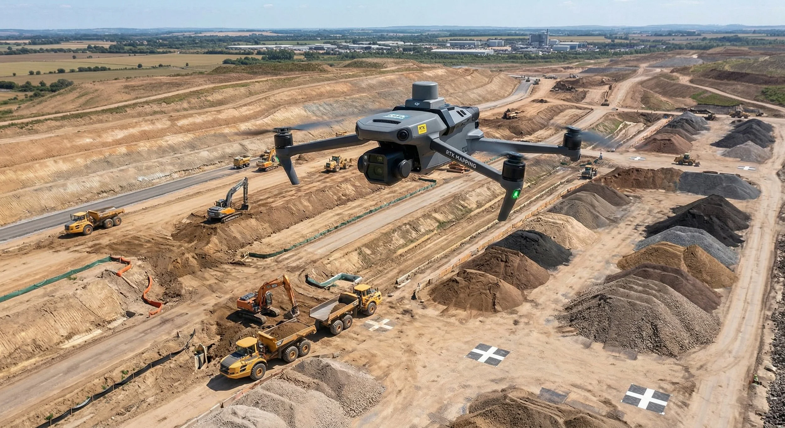
1. Aerial Photogrammetry: The Bird's-Eye View For our aerial capture, we use drones to perform photogrammetry. This involves flying over a site and capturing thousands of overlapping, high-resolution photographs, which our software then stitches into a cohesive 3D model or map.
Best for: Large-scale site overviews, topographic mapping of open areas, roof inspections, and volumetric measurements (like stockpiles).
The Advantage: Drones can cover massive areas of land quickly and cost-effectively. Because it uses actual photographs, the resulting digital twins and orthomosaics are photorealistic, making it incredibly easy for stakeholders to understand the visual context of the site.
When we use it: When you need to see the big picture, track earthwork progress, or get an updated, high-res map of your entire development.
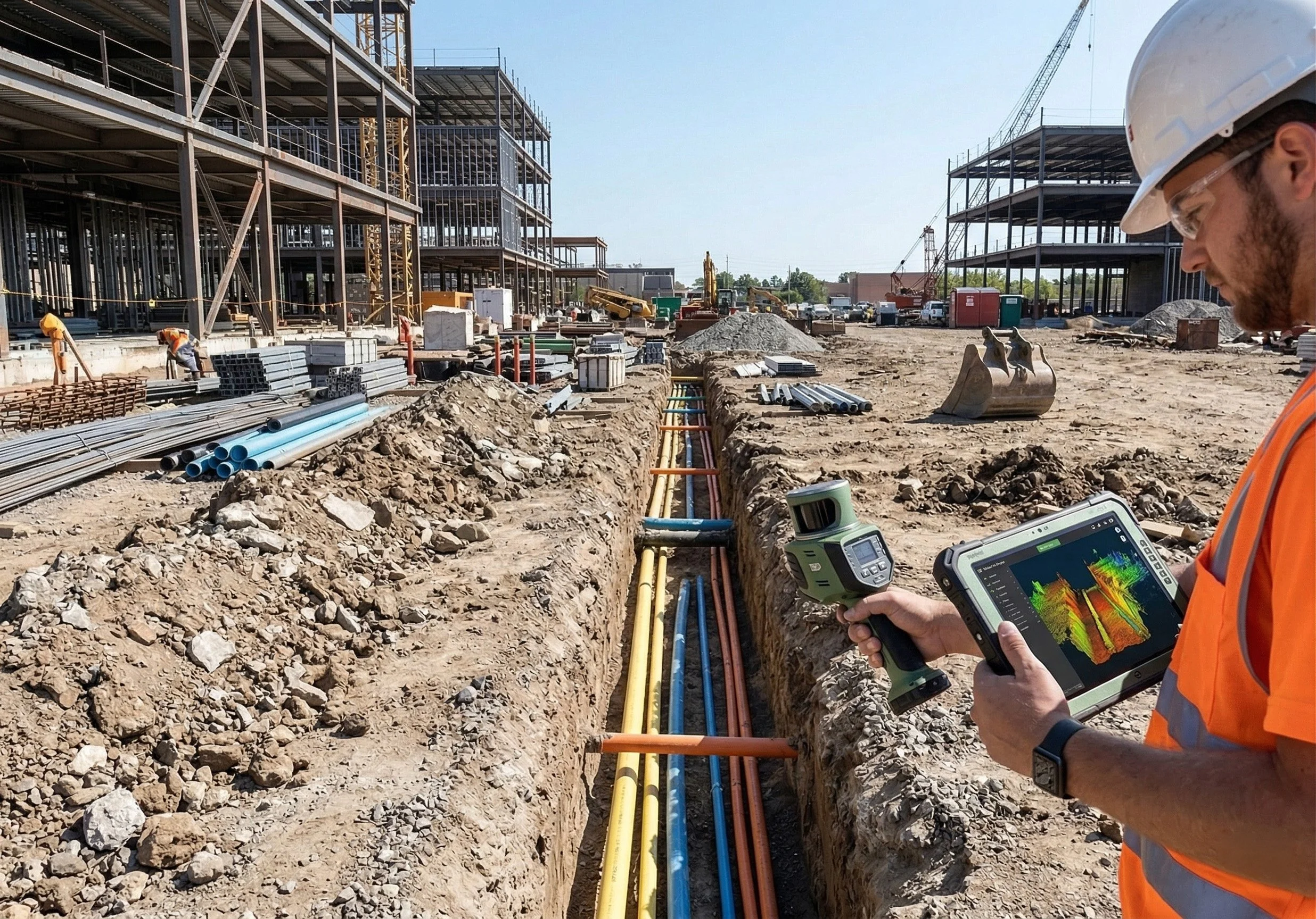
2. Terrestrial LiDAR: Ground-Level Precision When we need centimeter-level accuracy, complex structural details, or we need to map the indoors, we bring out the ground-based laser scanners (Terrestrial LiDAR).
Best for: Building interiors, complex mechanical/electrical/plumbing (MEP) systems, intricate architectural facades, and areas where drones cannot safely fly.
The Advantage: LiDAR uses active laser pulses to measure exact distances, capturing millions of data points per second. It doesn't rely on ambient light, and because it is stationed on the ground, it captures the critical structural details that a drone looking down from above might miss.
When we use it: When your engineers and architects need precise, as-built data of existing structures, ground-level assets, or interior spaces for BIM (Building Information Modeling).
The Ortho Maps Approach: A Hybrid Solution Why choose one when you can have the best of both? The true power of geomatics comes from merging these datasets. By combining the vast, photorealistic context of aerial photogrammetry with the accurate, structural detail of terrestrial LiDAR, we deliver a complete, flawless digital twin of your project—inside and out, top to bottom.
Stop guessing and start measuring. Whether you need an aerial map of a 50-acre site or a centimetre-accurate scan of a mechanical room, we have the right tool for the job. Contact Ortho Maps today to discuss your project.