
Beyond the Ground View: Modernizing Infrastructure Oversight with Aerial Asset Inspection
In the world of Architecture, Engineering, and Construction (AEC) and capital project development, the physical scale of the work is often matched only by the complexity of managing it. Traditional methods of monitoring progress and inspecting aging assets — relying heavily on ground crews, scaffolding, and elevated platforms — have long been the standard.
However, as project timelines tighten and safety regulations evolve, the industry is increasingly turning toward aerial solutions to gain a comprehensive, actionable view of reality.
At Ortho Maps, we see daily how aerial asset inspection and infrastructure oversight are moving from novelty additions to essential components of the project lifecycle. But what do these terms actually mean in practice, and how are they changing workflows in AEC?
Defining the Terms
It is helpful to separate these two closely related concepts:
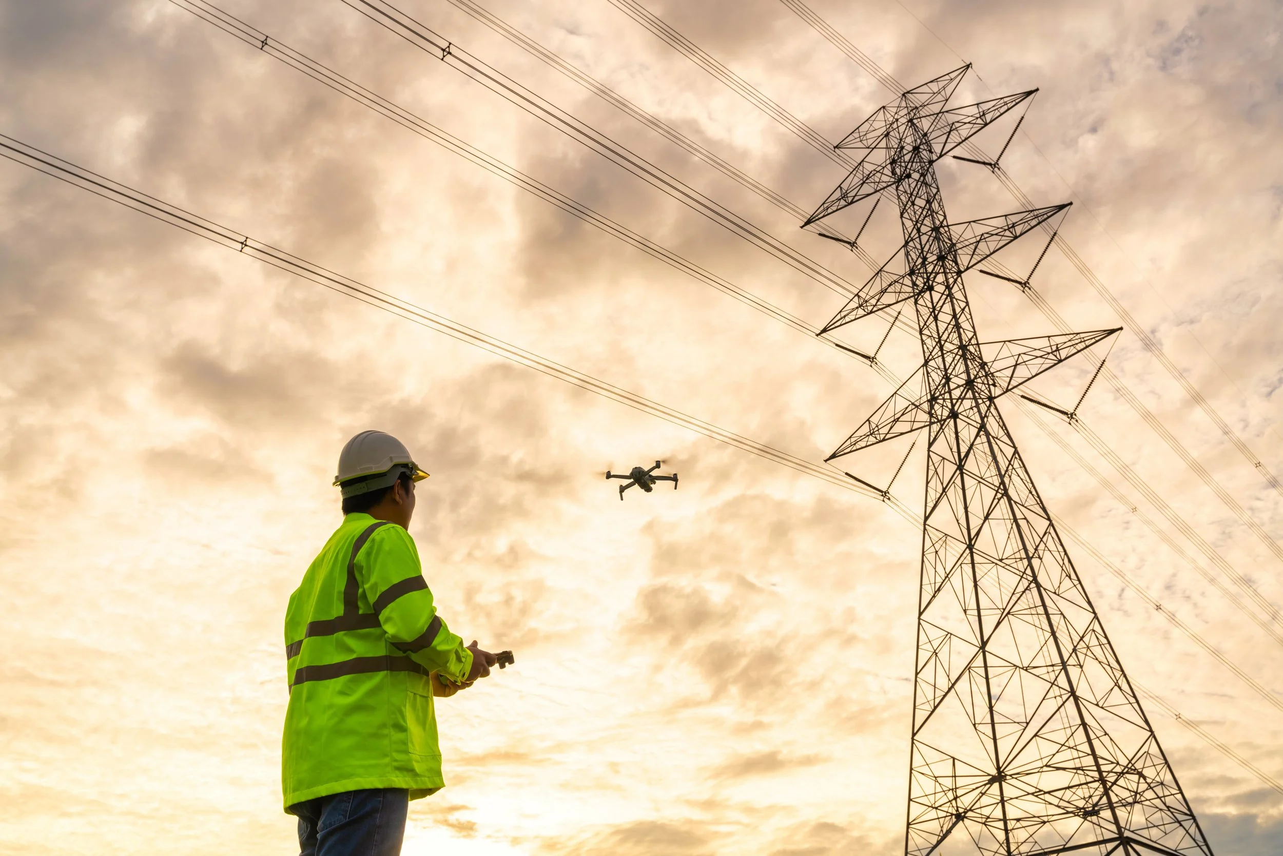
Aerial Asset Inspection is the focused examination of specific physical structures. It involves using uncrewed aerial systems (drones) equipped with high-resolution cameras to capture detailed data of hard-to-reach locations. Think of bridge undercrofts, high-rise facades, utility towers, or complex roofing systems.
Infrastructure Oversight is a broader concept. It is the ongoing, macro-level monitoring of a site or network of assets over time. This is less about finding a hairline crack in concrete today, and more about tracking earthworks progress over a month, monitoring site logistics, or ensuring environmental compliance across miles of pipeline right-of-way.
Practical Applications in AEC and Capital Projects
The real value of these technologies lies not just in the flying, but in the data deliverables that allow engineers and project managers to make better decisions from their desks.
Here is what is currently being done in the field:
1. Pre-Construction and Site Due Diligence
Before ground is broken, aerial oversight provides crucial baseline data. High-accuracy orthomosaics and topographic maps help developers understand existing site conditions, plan logistics, and identify potential drainage or access issues that ground analysis might miss.
2. Active Construction Progress Monitoring
For capital projects, maintaining the schedule is paramount. Regular aerial oversight creates a visual timeline of the project. This data is often ingested into BIM software to compare the "as-built" reality against the "as-designed" plans, allowing teams to catch deviations early before they become expensive rework problems.
3. High-Risk Asset Inspections
This is where safety concerns are significantly reduced. Instead of sending personnel hanging from ropes to inspect wind turbine blades or scaffolding up the side of a cooling tower, high-zoom aerial imagery can resolve fine surface detail from a safe standoff. This keeps personnel on the ground while giving inspectors a clear, geolocated visual record of conditions they’d otherwise have to reach by rope or scaffold.
4. Handover and "Digital Twins"
At project closeout, a final, comprehensive aerial scan provides owner-operators with a complete record of the asset at handover. This data forms the foundation of a "digital twin," serving as a baseline for all future maintenance and structural health monitoring.
The Shift Toward Data-Driven Oversight
Moving towards aerial inspection isn't just about using new gadgets; it's about improving data integrity. By digitizing the physical asset, stakeholders get objective, repeatable records rather than subjective field notes.
Whether it’s verifying earthwork volumes or inspecting critical infrastructure, aerial solutions provide the clarity needed to manage complex capital projects safely and efficiently.
Get in touch with Ortho Maps today to discuss how we can support your project oversight and asset inspections.