
Beyond the Surface: Understanding Topography Analysis in Capital Projects
Before a single foundation is poured or a road alignment is finalized, construction begins with data. In the complex world of Architecture, Engineering, and Construction (AEC), understanding the existing ground conditions is paramount. This is the domain of topography analysis — often referred to as topographic mapping.
While a standard 2D map shows you where things are horizontally, topography analysis adds the crucial vertical dimension, defining the shape, contours, and features of the terrain.
Here is a breakdown of what this analysis entails and why it is the critical bedrock of successful capital project development.
What is Topography Analysis?
At its core, topography analysis is the process of measuring and mapping the physical features of a specific land area. This includes natural elements like hills, valleys, streams, and vegetation, as well as man-made features such as existing buildings, roads, fences, and utility poles.
Traditionally, this was done solely with ground teams using total stations and GNSS rovers. Today, modern design geomatics often integrates aerial data capture — using Drone Photogrammetry — to create highly dense, accurate 3D models of large sites in a fraction of the time.
The output isn't just a pretty picture; it’s a mathematically accurate digital twin of the existing site conditions.
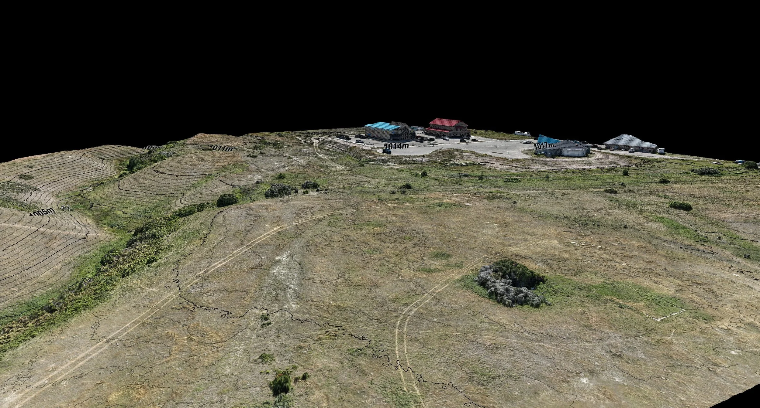
Engineering-grade contour map overlaying a high-fidelity reality capture of a planned project site.
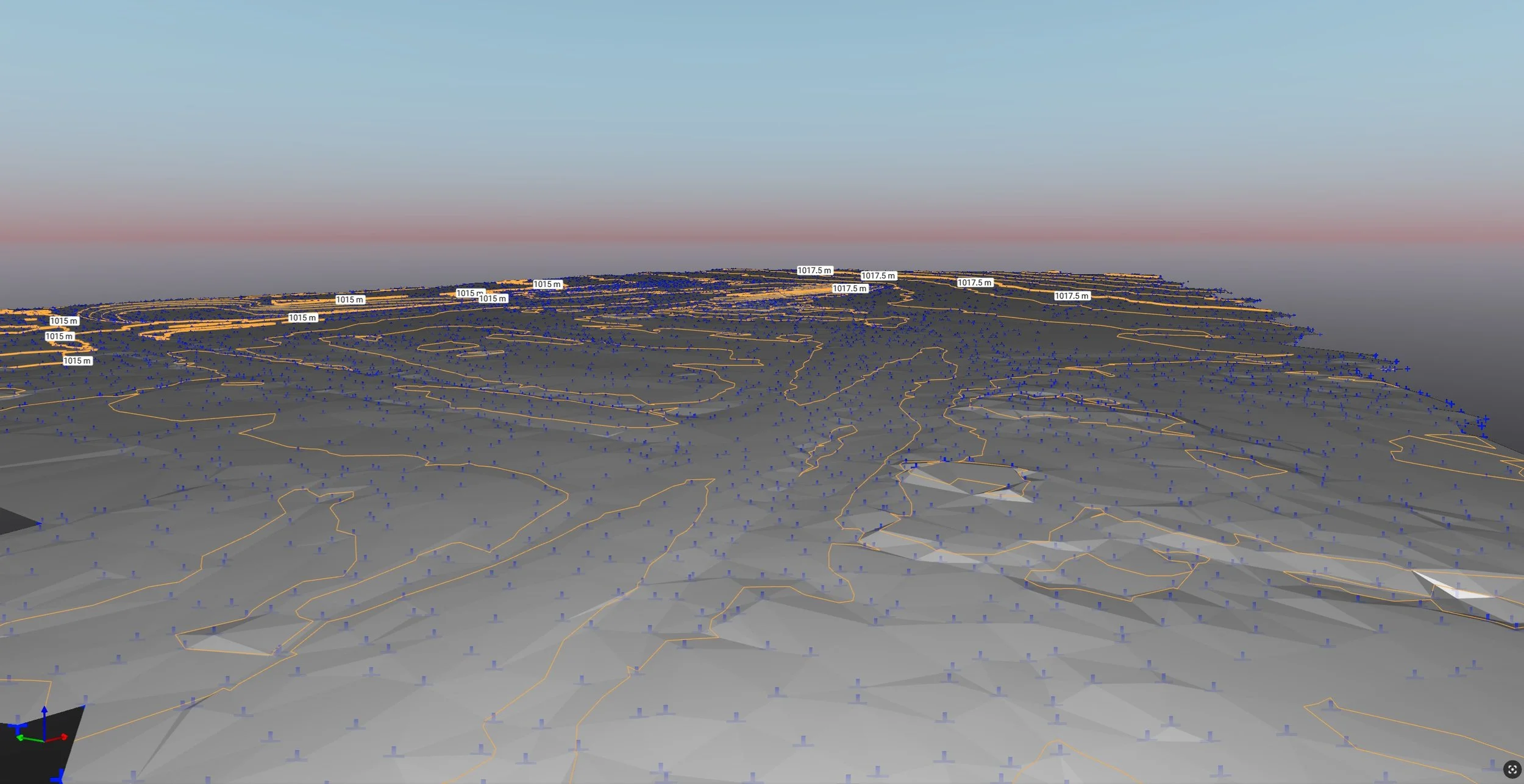
Processed 3D TIN-surface of a development area showing the simplified terrain features and contour indices overtop.
From Raw Data to Actionable Insight
A raw point cloud or a series of aerial photos is just the starting point. The real value lies in the post-processing and analysis derived from that data. By processing this information, we can generate several critical outputs for engineering teams:
Contour Mapping: Creating topographic maps that visualize elevations and surface shapes through contour lines.
Slope and Aspect Analysis: Identifying steepness and the direction slopes face. This is vital for understanding drainage patterns, solar exposure, and buildability constraint.
Hydrographic Modeling: Analyzing how water flows across a site, identifying watershed areas, potential pooling zones, and natural drainage paths.
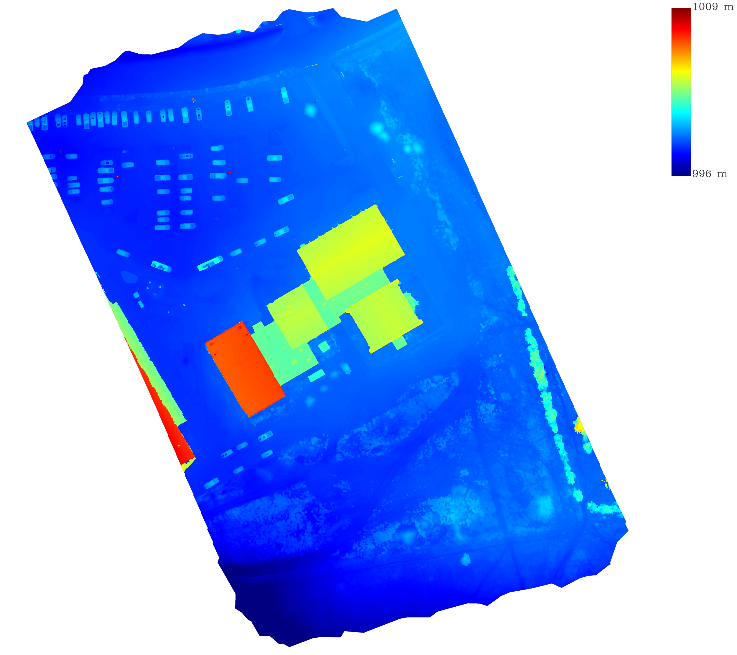
Processed data visualized as topographic heatmap, helping planners identify buildable zones and drainage challenges.
Applications in AEC and Capital Projects
Why does this matter for capital project development? Accurate topography is risk mitigation.
Inadequate ground geomatics data is a leading cause of project delays and budget overruns in construction. When designers work with outdated or low-resolution terrain data, they encounter expensive surprises once excavations begin.
High-quality topography analysis is essential for:
Site Selection & Feasibility: Determining if a parcel of land is suitable for the intended development based on its slope and natural features.
Earthworks & Volumetrics: This is perhaps the most critical financial application. Accurate topography allows engineers to calculate Cut and Fill Volumes precisely. Knowing exactly how much soil needs to be moved, imported, or exported drastically improves bid accuracy.
Civil Design & Drainage: Designing effective stormwater management systems requires a precise understanding of existing gravity flow, which only detailed topography can provide.
As-Built Verification: During construction, comparing new topographical scans against original design models ensures the project is being built to spec.
The Foundation of a Successful Build
In capital projects, assumptions are expensive. Topography analysis replaces assumptions with measurable ground truth. By investing in accurate terrain mapping at the planning stage, AEC firms build their projects on a foundation of reliable data.
To see how Ortho Maps utilizes advanced aerial mapping to deliver engineering-grade topographic data, view our solutions or get in touch with us.