Precision from Every Angle. Data for Every Decision.
Ortho Maps delivers a comprehensive suite of project intelligence. From high-accuracy 3D modeling to detailed site inspections, we provide the integrated geomatics required to monitor, measure, and manage project delivery with certainty.
Orthophotos
•
Cartography
•
Digital Twins
•
Reality Capture
•
Aerial Inspection
•
GIS Analysis
•
Terrain Mapping
•
Site Digitization
•
3D Visualization
•
Topography
•
Contour Mapping
•
Terrestrial SLAM
•
Cut/Fill
•
Stockpiles
•
Takeoffs
•
Hydrology
•
360° Capture
•
Orthophotos • Cartography • Digital Twins • Reality Capture • Aerial Inspection • GIS Analysis • Terrain Mapping • Site Digitization • 3D Visualization • Topography • Contour Mapping • Terrestrial SLAM • Cut/Fill • Stockpiles • Takeoffs • Hydrology • 360° Capture •
-
The Common Visual Language. Replace outdated satellite imagery with high-resolution, centimeter-accurate 2D maps. Our orthomosaics provide a current, distortion-free digital baseline that ensures all stakeholders are planning and coordinating from the same source of truth. Read more…
-
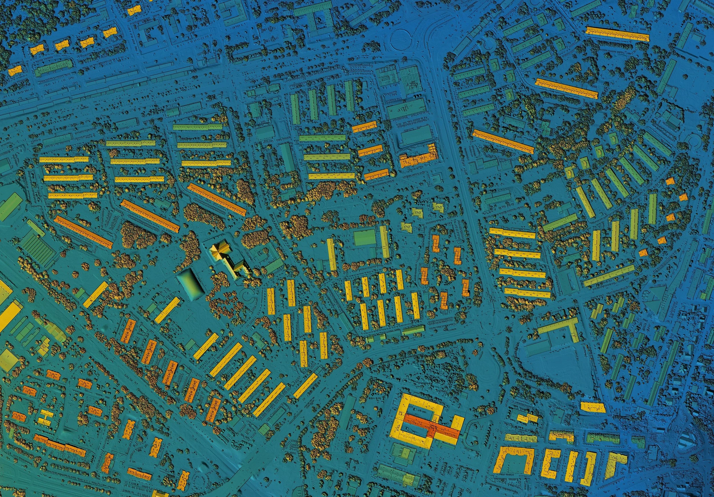
Reality Capture, Reimagined. Transform your project site into an immersive digital twin. Using advanced photogrammetry, we create high-fidelity 3D models that allow for virtual site walkthroughs and seamless integration into modern BIM and design workflows. Read more…
-
Precision Earthworks Verification. Eliminate the guesswork in material management. Our volumetric services provide rapid, high-accuracy calculations for stockpiles and cut-and-fill quantities, allowing for real-time inventory tracking and cost control. Read more…
-
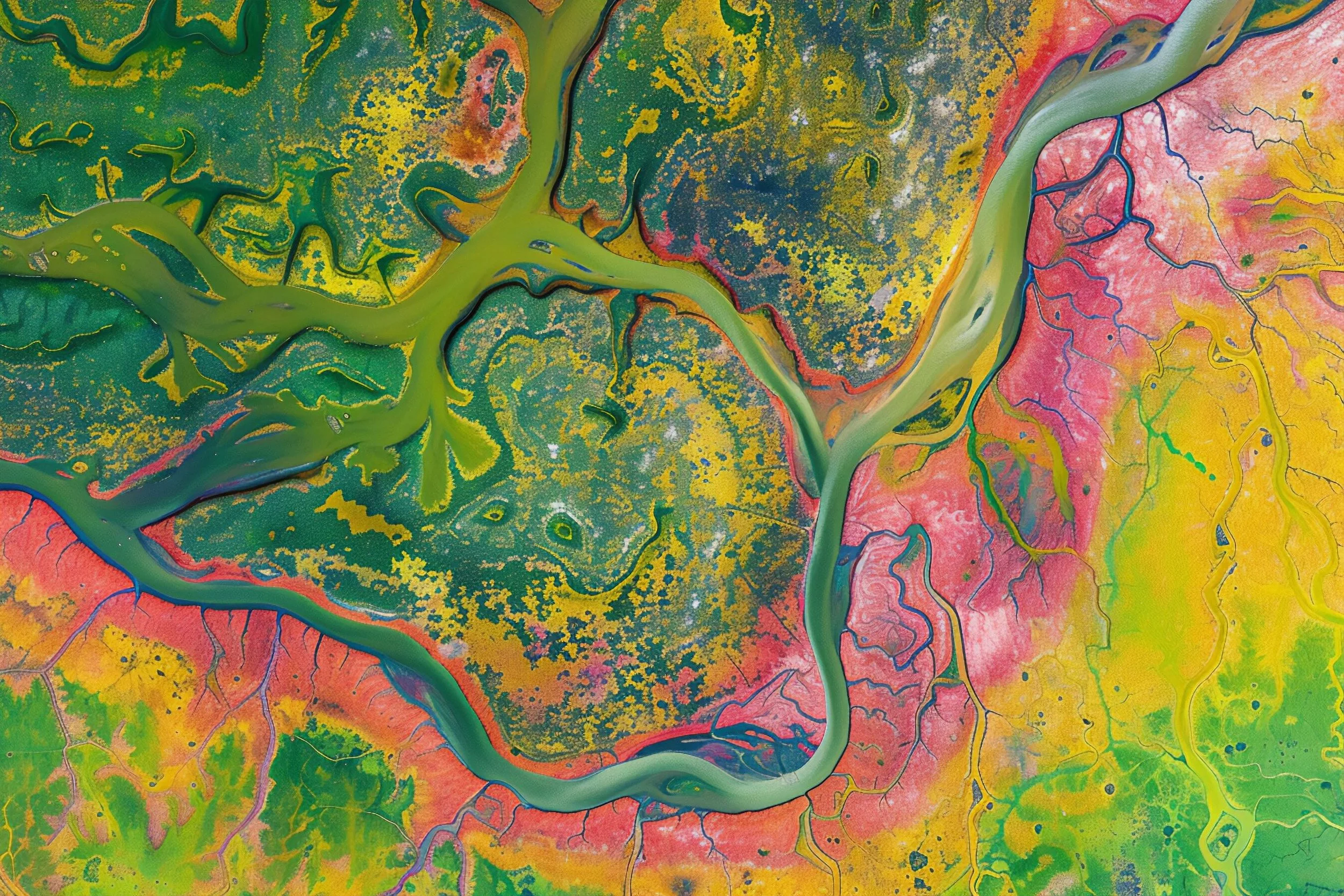
Strategic Spatial Intelligence. We transform complex reality capture into authoritative cartographic deliverables for smarter project delivery. Our GIS analysis synchronizes multi-layered data into a clear visual language for all stakeholders. Read more…
-
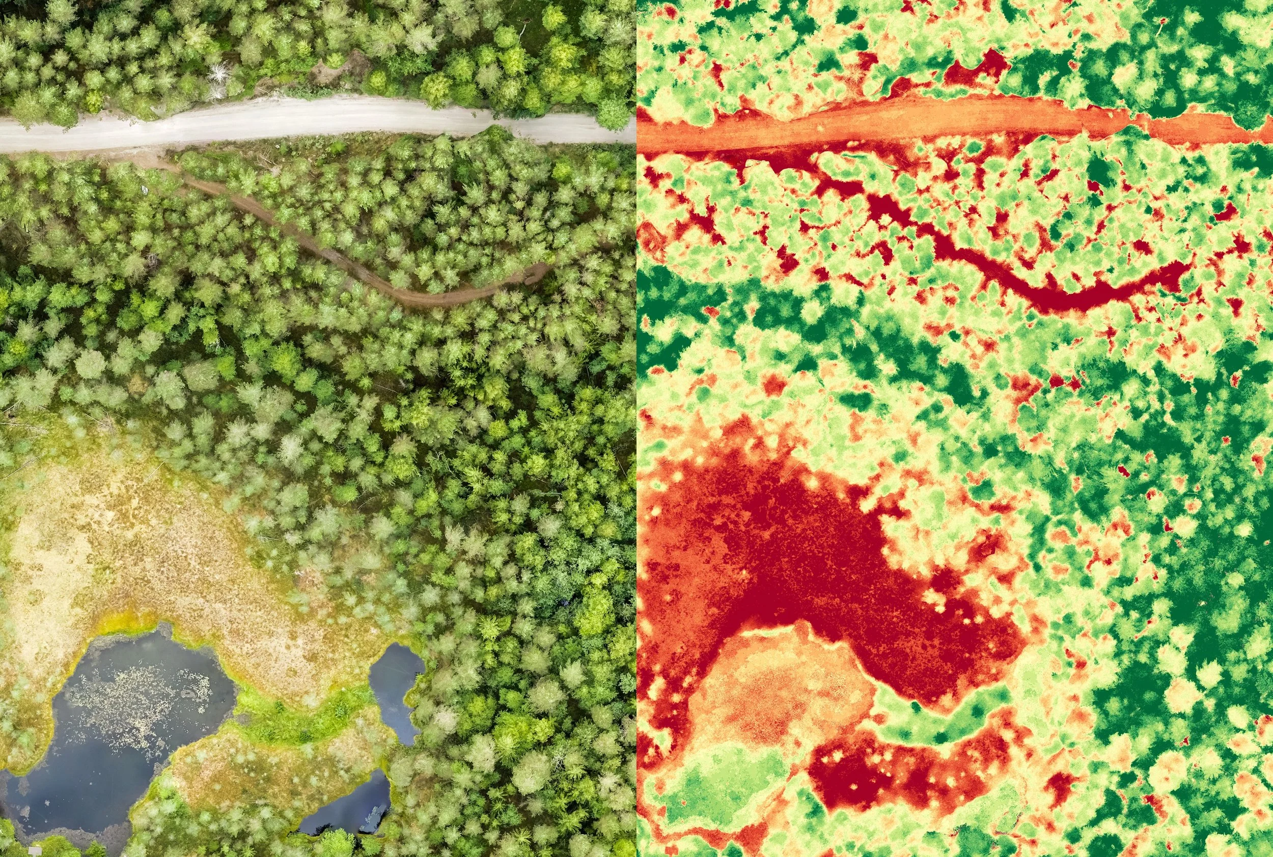
Engineering-Grade Terrain Data. Go beyond basic visuals with precise topographic mapping. We deliver the engineering-grade contour lines and terrain models required for drainage analysis, grading, and site-prep specifications with rigorous technical accuracy. Read more…
-
Critical Infrastructure Oversight. Access the inaccessible without the risk. Equipped with advanced sensors, we provide high-resolution visual and thermal inspections of critical assets, delivering the detailed data needed for structural integrity assessments and maintenance planning. Read more…
-
Precision beyond the canopy. By combining high-accuracy SLAM LiDAR for interior as-builts with immersive 360° site walkthroughs, we provide a complete digital record from the ground up. This terrestrial data enables seamless remote inspections and enhances stakeholder accountability. Read more…