
Topographic Mapping
Bare-earth terrain your civil team can design on
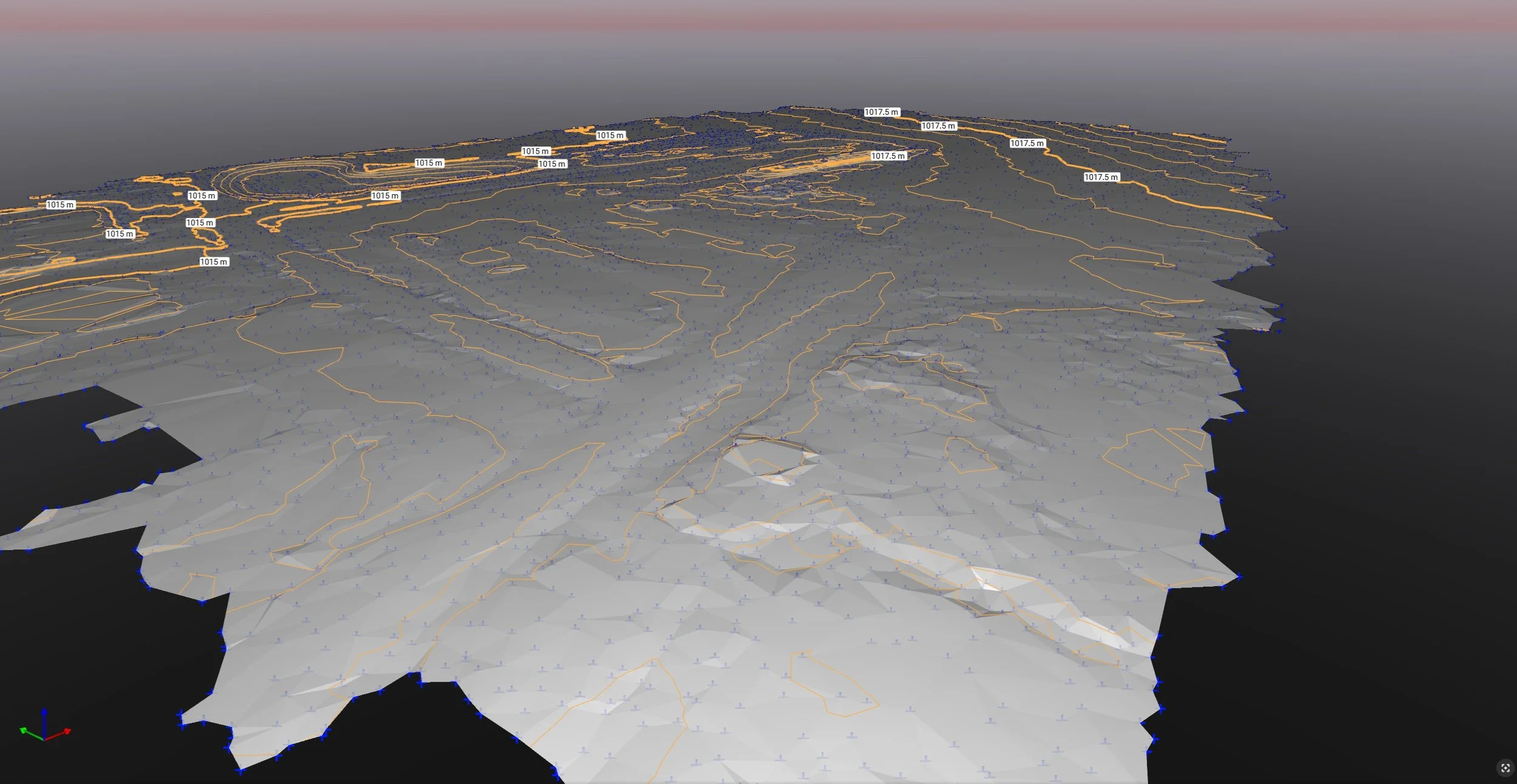
A topographic map isn’t a visualization — it’s the vertical truth a grading plan, a drainage model, and a road alignment all stand on. We deliver the Digital Terrain Models and contours that feed those workflows directly, built to a tolerance civil design can rely on rather than a render that merely looks like the ground.
The work is in getting to bare earth. From the captured surface we classify out vegetation, structures, and transient objects to isolate the actual terrain — because a grading plan built over the elevation of a parked dozer or a brush pile is wrong before it starts.
What you get, and why it holds
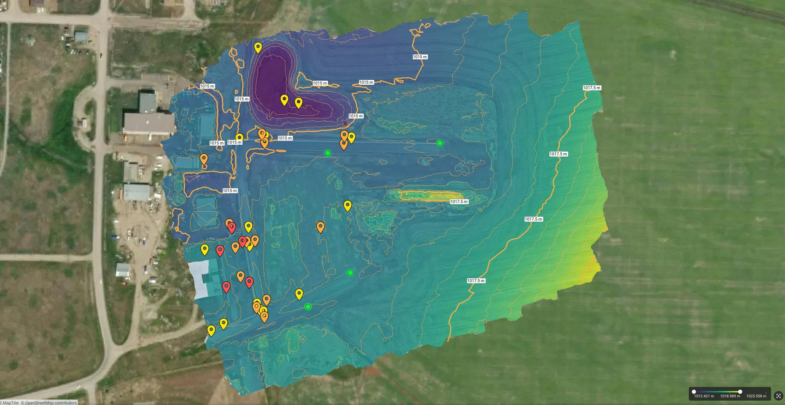
• Bare-earth DTMs and contours, classified from a dense surface and tied to ground control on the Alberta 3TM projection, so the vertical data is traceable to known checkpoints.
• Delivered at true ground scale, so the surface drops straight into Civil 3D or Bentley without coordinate translation, ready for grading and utility design.
• The micro-topography that drives water — precise enough to model flow, size retention, and place culverts on bare earth rather than guesswork.
• A baseline you can re-fly to monitor subsidence, erosion, or slope movement over time.
Where it fits
• Feasibility — Map steep slopes, drainage divides, and flood-prone depressions, and locate environmental setbacks before the first site plan is drawn.
• Design — Hand engineers the source-of-truth DTM for grading, drainage, and line-of-sight, and write site-prep specs from real vertical data.
• Pre-construction — Run stormwater modelling on bare earth to validate pond sizing and culvert placement.
• Construction & operations — Check as-built grade against the design surface within tolerance, and watch embankments for early signs of erosion or movement.