
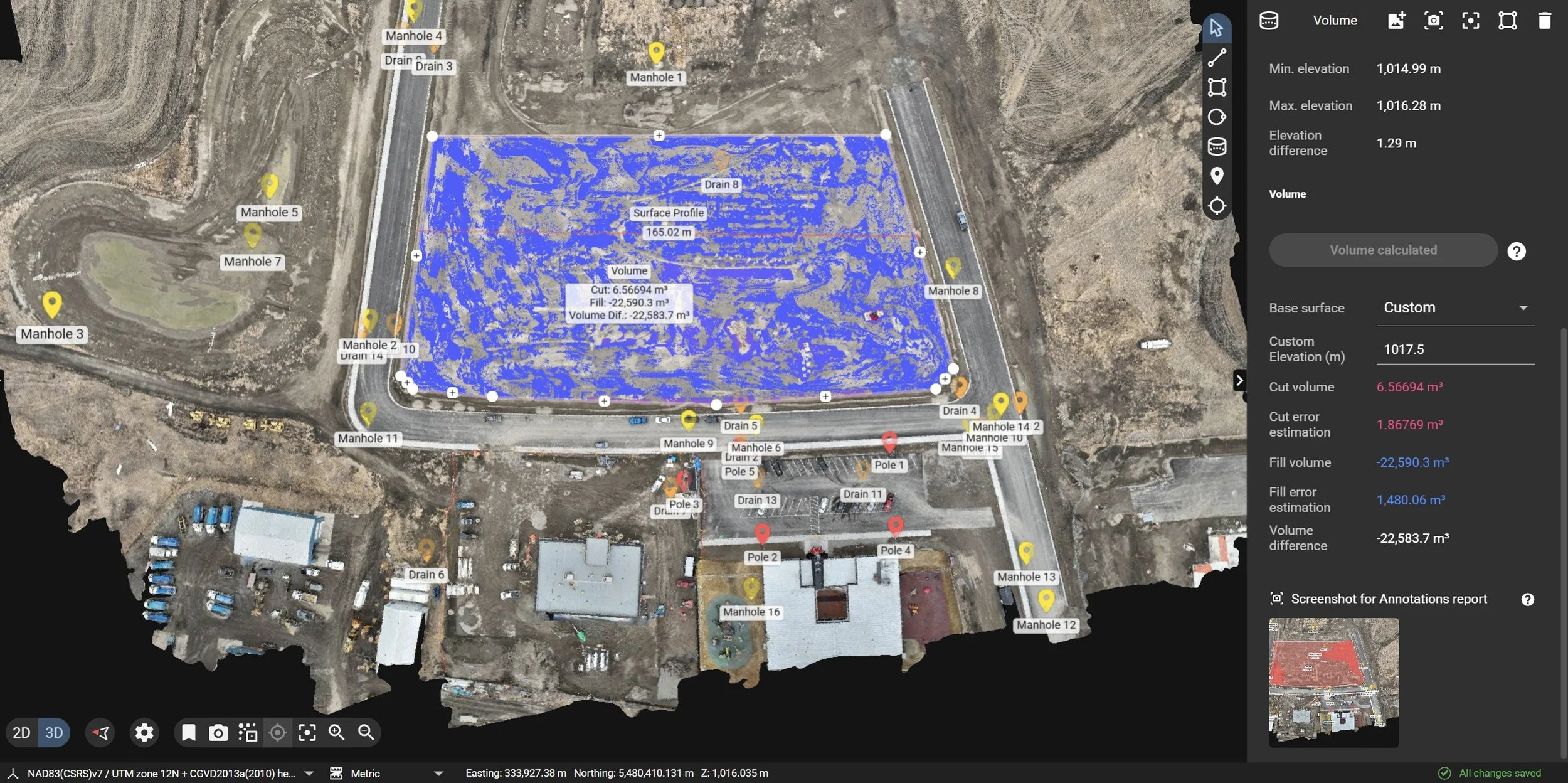
Cut/Fill Quantification
Verifiable earthwork volumes — measured, not estimated
On an earthworks site, the gap between a 3% and a 10% error isn’t a rounding detail; it’s a line item that moves real capital. Truck counts, manual stakeouts, and month-end estimates share one weakness: they sample a handful of points and interpolate across everything in between. The volume hides in the in-between.
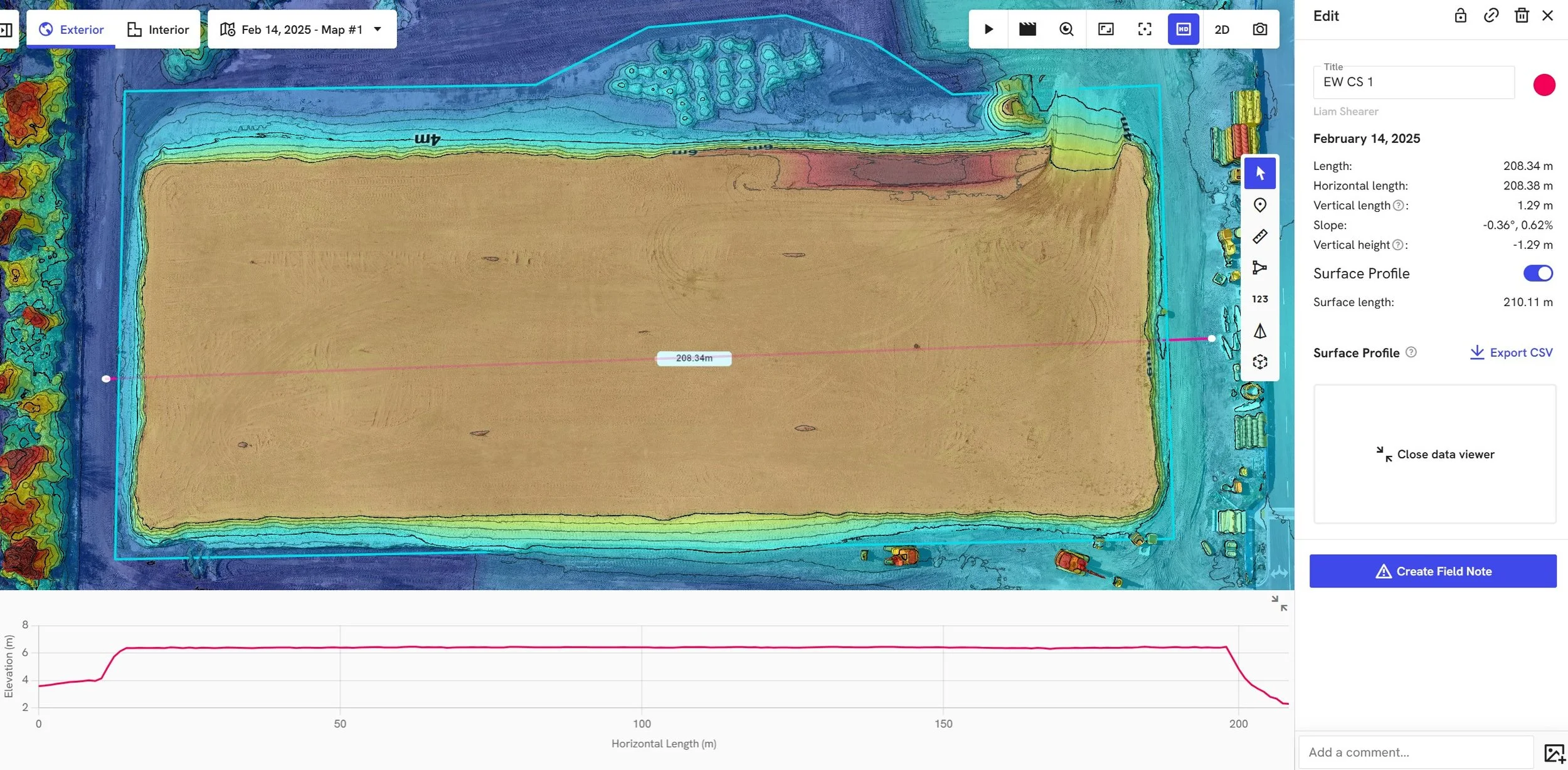
We measure the whole surface instead. A single flight captures millions of elevation points across a pile or grading area, building a dense 3D model of the ground as it actually sits — not a best guess stretched between survey stakes. The output is an auditable volume you can put in front of a client, a subcontractor, or a financial controller and defend.
How the numbers hold up
A traditional GNSS or total-station survey is highly accurate at each point it takes — but it takes dozens, perhaps hundreds; whereas we take millions. For irregular stockpiles and complex grading, that density is the difference between a representative surface and an educated approximation.
Every dataset is tied to ground control on the Alberta 3TM projection and checked against independent checkpoints, so accuracy is traceable rather than assumed. We report each volume with an uncertainty bound derived from the capture’s own vertical residuals and the measured footprint — typically within a few percent on well-defined piles — so you know exactly how much confidence the figure carries. And we’re explicit about what photogrammetry can’t see through: standing water, heavy vegetation, or material with significant swell, compaction, or moisture variation. Where in-situ and loose volumes differ, we say so up front.
Where it fits in the project
• Tender & takeover — Establish a “Day Zero” surface so you’re accountable only for material moved on your watch, and cross-check the official quantities before you commit a bid.
• Site prep — Track stripped topsoil and cleared material by volume, so nothing disappears and enough remains for final landscaping.
• Active earthworks — Produce auditable cut/fill reports for progress billing and real-time site balancing, replacing truck-count math with a defensible record.
• Inventory — Measure aggregate, ore, or mulch piles on a repeatable cadence, without putting anyone on an unstable slope.
• Close-out — Deliver a final pre- versus post-construction reconciliation to settle earthworks contracts and satisfy financial or tax audits.