
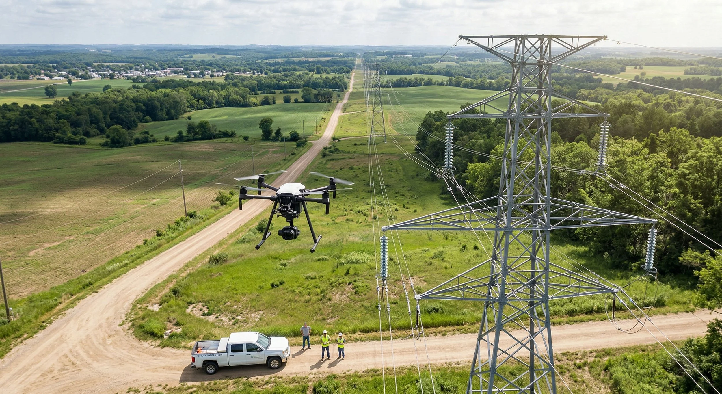
Beyond the Ground View: Modernizing Infrastructure Oversight with Aerial Asset Inspection
In the complex world of AEC and capital project development, traditional methods of inspecting assets and monitoring sites are being challenged by safety concerns and tight timelines. Learn how these technologies are providing the data needed to manage projects more effectively.
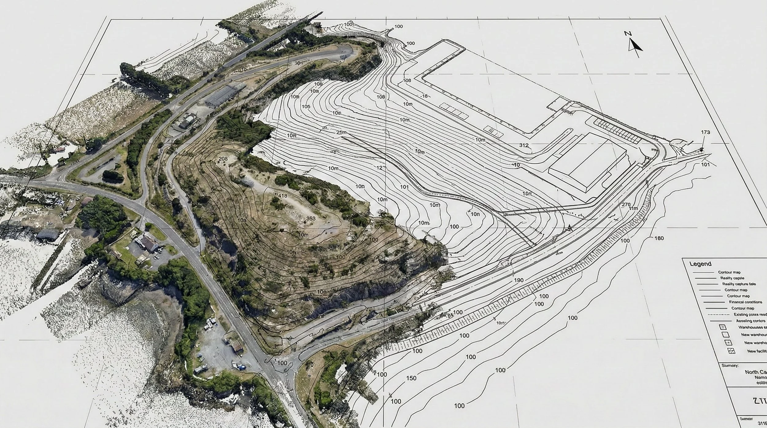
Beyond the Surface: Understanding Topography Analysis in Capital Projects
Before construction begins, understanding the ground truth is essential. Topography analysis, or mapping, provides the critical vertical data defining a site's terrain. Learn how this data is captured, analyzed for factors like slope and water flow, and why it is the bedrock of risk mitigation in AEC and capital project development.
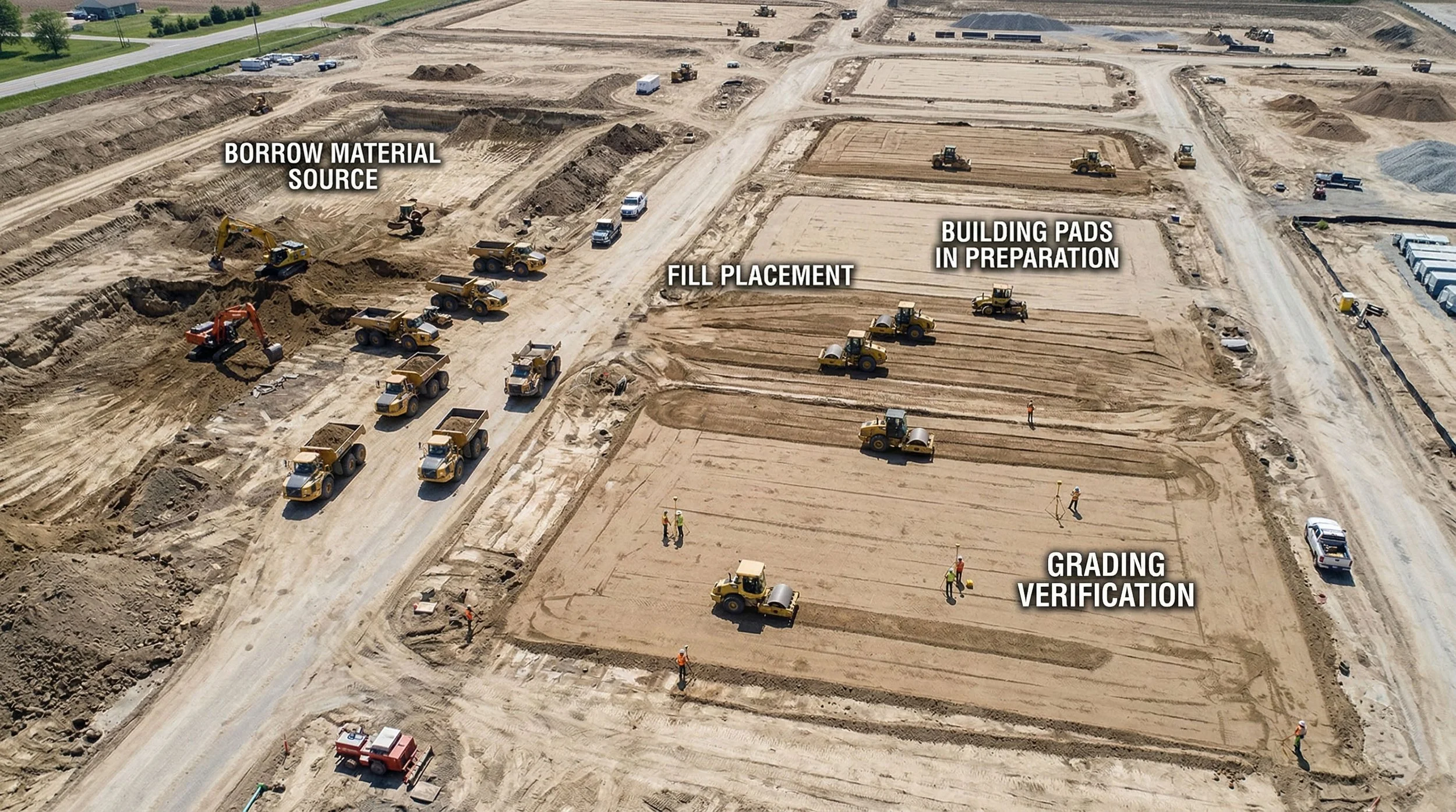
Beyond the Dirt: Understanding Volumetric Analysis in Capital Projects
Moving earth is one of the biggest costs in construction projects. Discover how modern volumetric analysis — using drone data for stockpile measurements, cut/fill calculations, and QA/QC — is replacing outdated estimation methods with precise, verifiable data that mitigates risk and improves project budgeting.
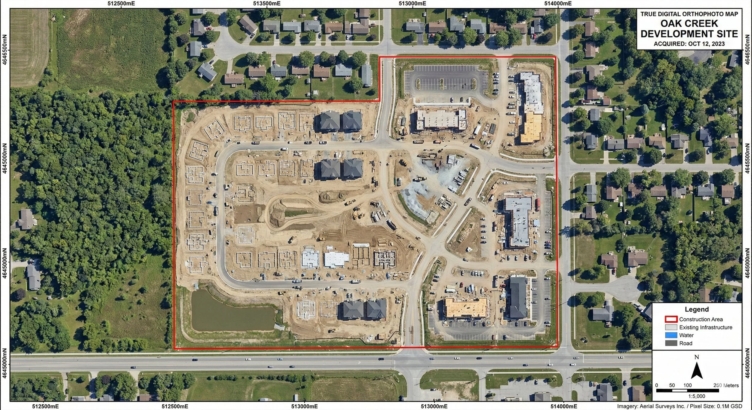
Beyond the Aerial Photo: Understanding Orthographic Mapping in Capital Projects
Before construction begins, understanding the ground truth is essential. Orthophoto mapping provides the critical, distortion-free visual data defining a site's exact layout. Learn how this imagery is captured, orthorectified for precise measurements, and why it is the bedrock of risk mitigation in AEC and capital project development.