
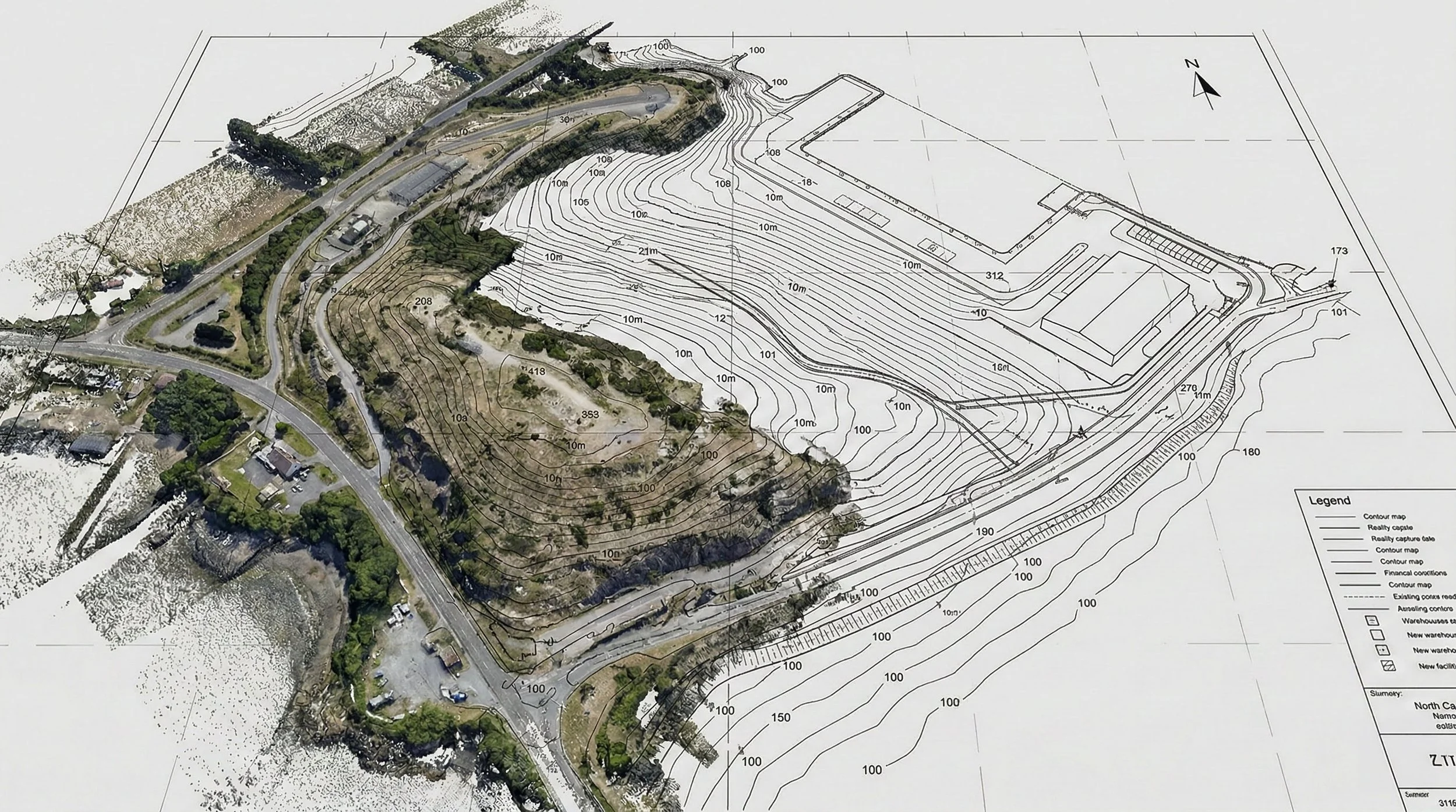
Beyond the Surface: Understanding Topography Analysis in Capital Projects
Before construction begins, understanding the ground truth is essential. Topography analysis, or mapping, provides the critical vertical data defining a site's terrain. Learn how this data is captured, analyzed for factors like slope and water flow, and why it is the bedrock of risk mitigation in AEC and capital project development.
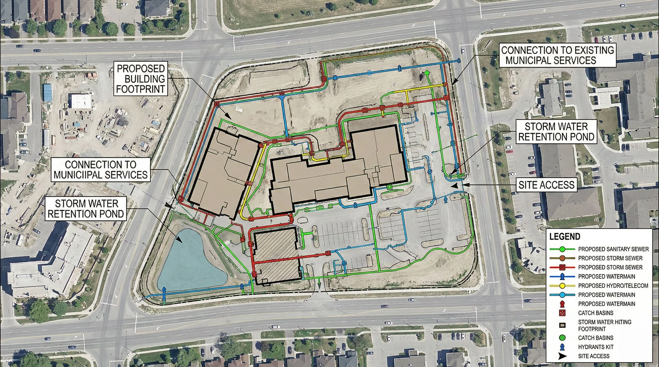
Beyond the Lines: Cartography and GIS in Capital Projects
Capital projects are complex puzzles where every piece has a location. This post breaks down the crucial difference between Cartography (the art of communication) and GIS Analysis (the science of data), and how combining them unlocks smarter decision-making in AEC and development.
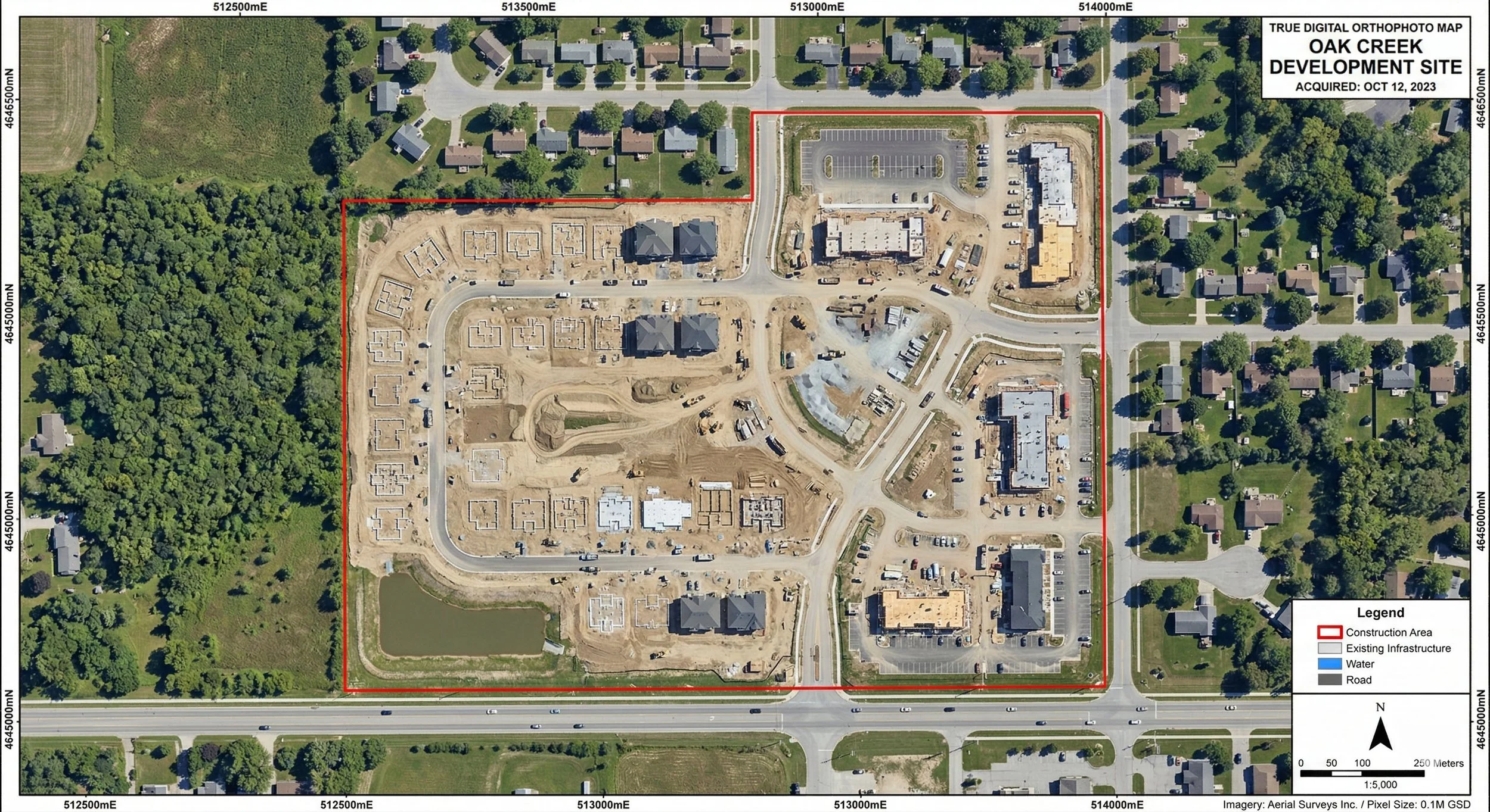
Beyond the Aerial Photo: Understanding Orthographic Mapping in Capital Projects
Before construction begins, understanding the ground truth is essential. Orthophoto mapping provides the critical, distortion-free visual data defining a site's exact layout. Learn how this imagery is captured, orthorectified for precise measurements, and why it is the bedrock of risk mitigation in AEC and capital project development.