

The Future of Land Development: Why Reality Capture is No Longer "Optional"
Reality capture is no longer a luxury—it’s a necessity. From "always-on" site monitoring to AI-driven analysis, discover the trends shaping the future of land development and geomatics.
A Common Visual Language: Driving Smarter Project Delivery with Ortho Maps
At Ortho Maps, we don’t just capture data — we deliver spatial intelligence. Explore how our integrated geomatics solutions bring stakeholders together and drive smarter project delivery from planning to turnover.
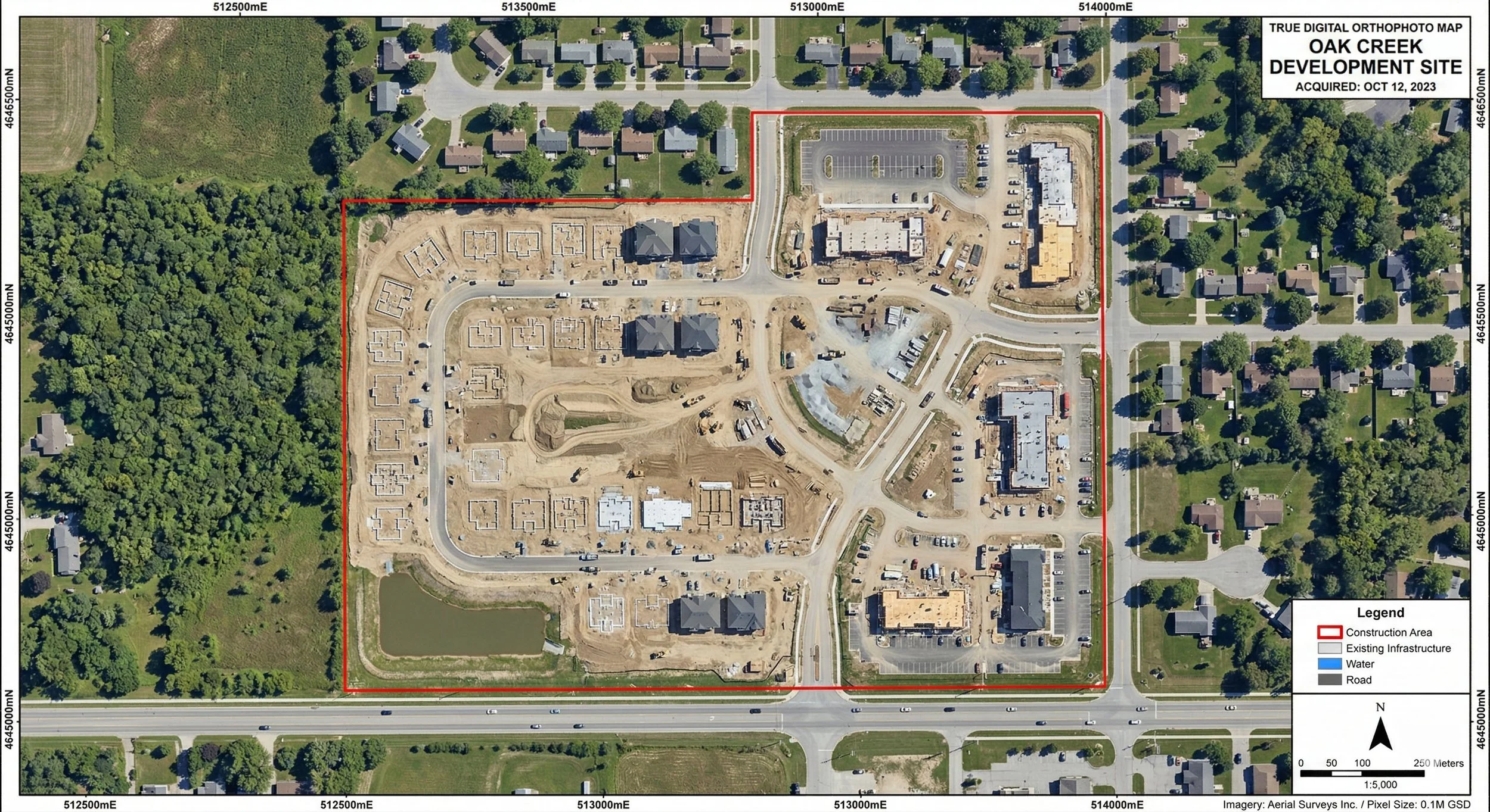
Beyond the Aerial Photo: Understanding Orthographic Mapping in Capital Projects
Before construction begins, understanding the ground truth is essential. Orthophoto mapping provides the critical, distortion-free visual data defining a site's exact layout. Learn how this imagery is captured, orthorectified for precise measurements, and why it is the bedrock of risk mitigation in AEC and capital project development.