
Precision in Practice: The Portfolio of Record.
From large-scale site development to complex infrastructure inspections — examine the spatial intelligence that empowers our clients to maintain project continuity and execute with absolute certainty.
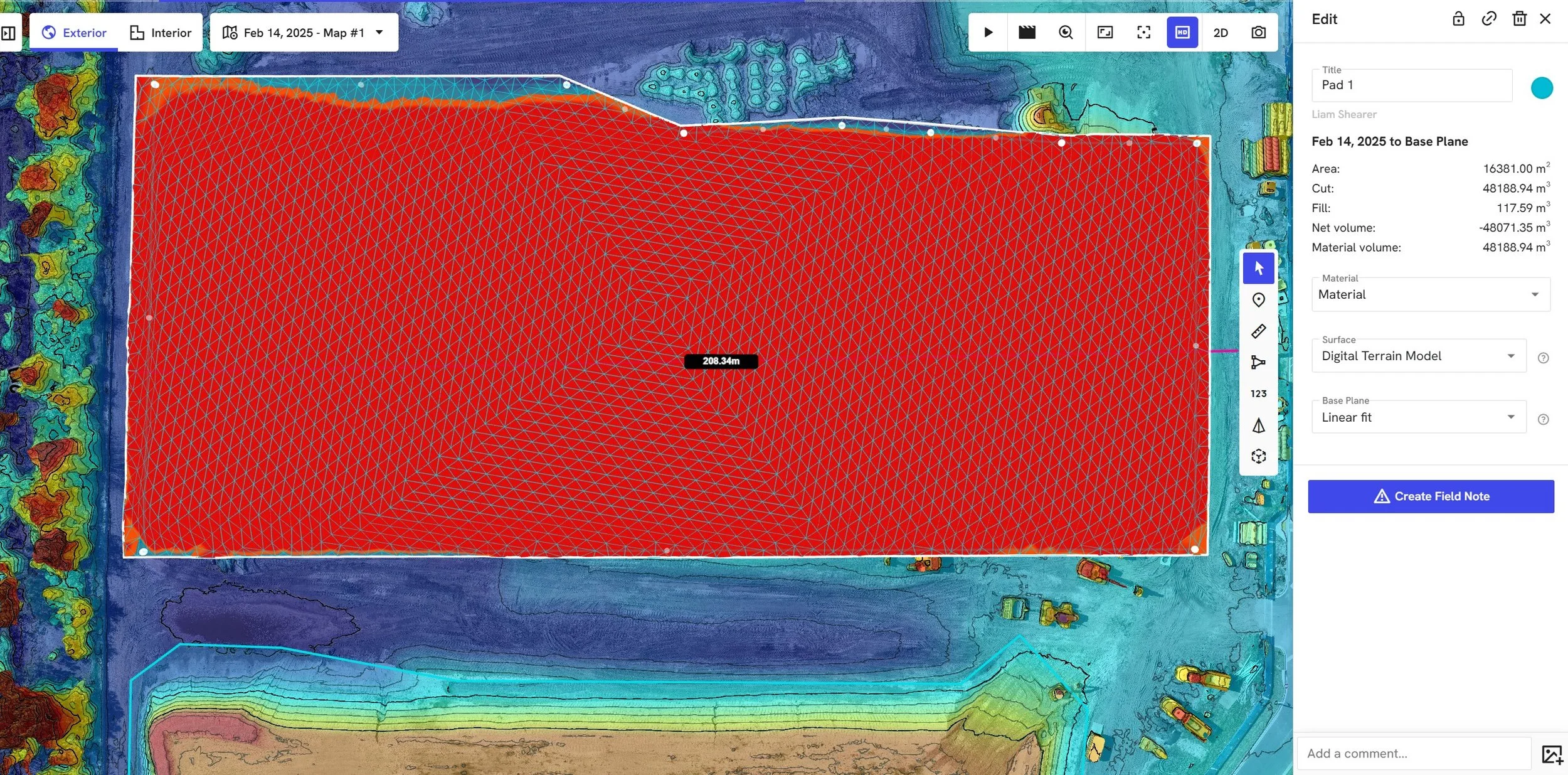
A building pad's finished volume quantified against the sites base plane.
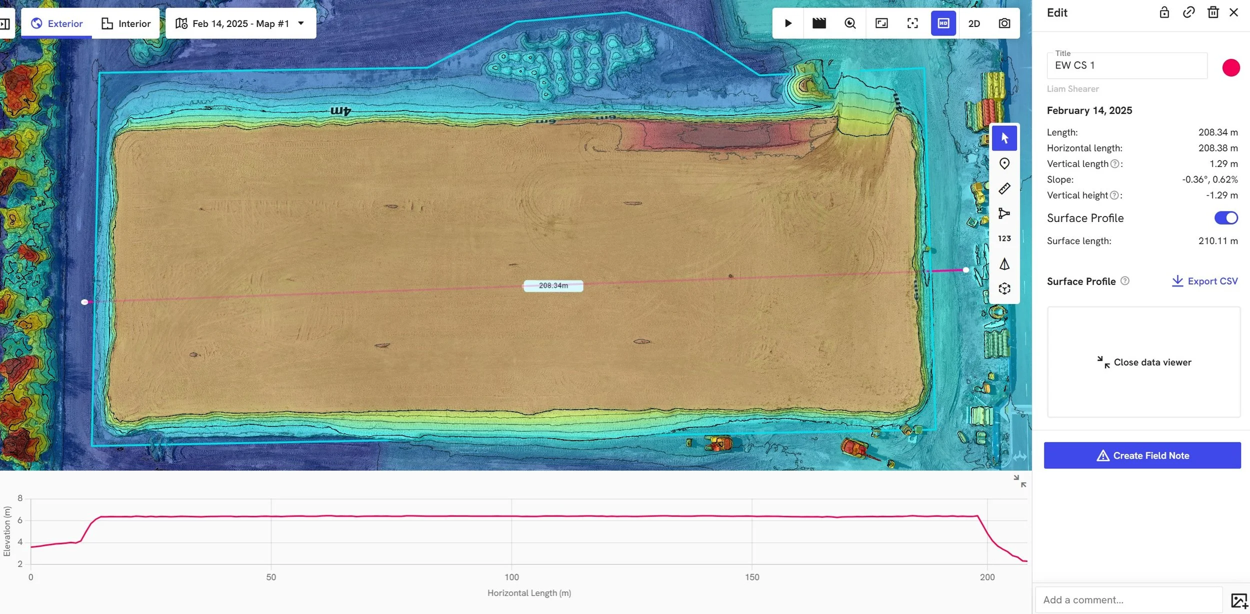
A building pad's finished volume surface profile represented as a 2D cross-section elevation graph.
A cloud-based platform allowing clients to annotate, measure and quantify volumes of a particular in both 2D and 3D.
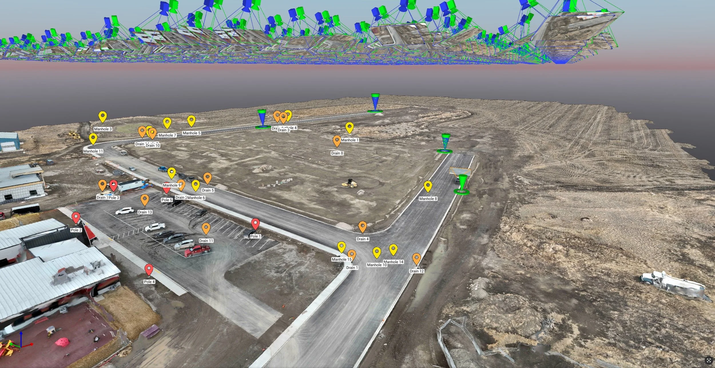
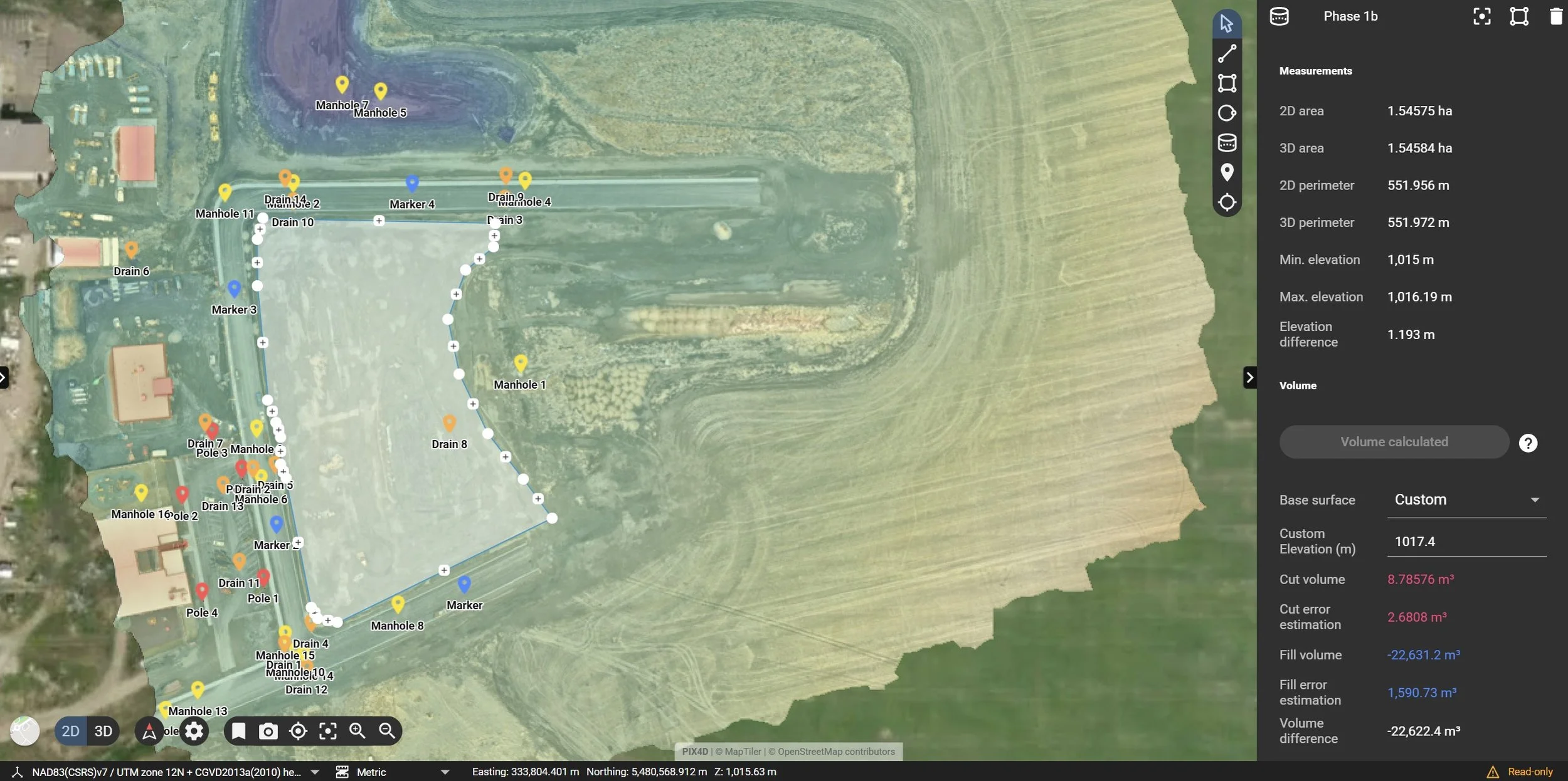
A digital twin model of a first-phase subdivision mapping locations of deep utility features.
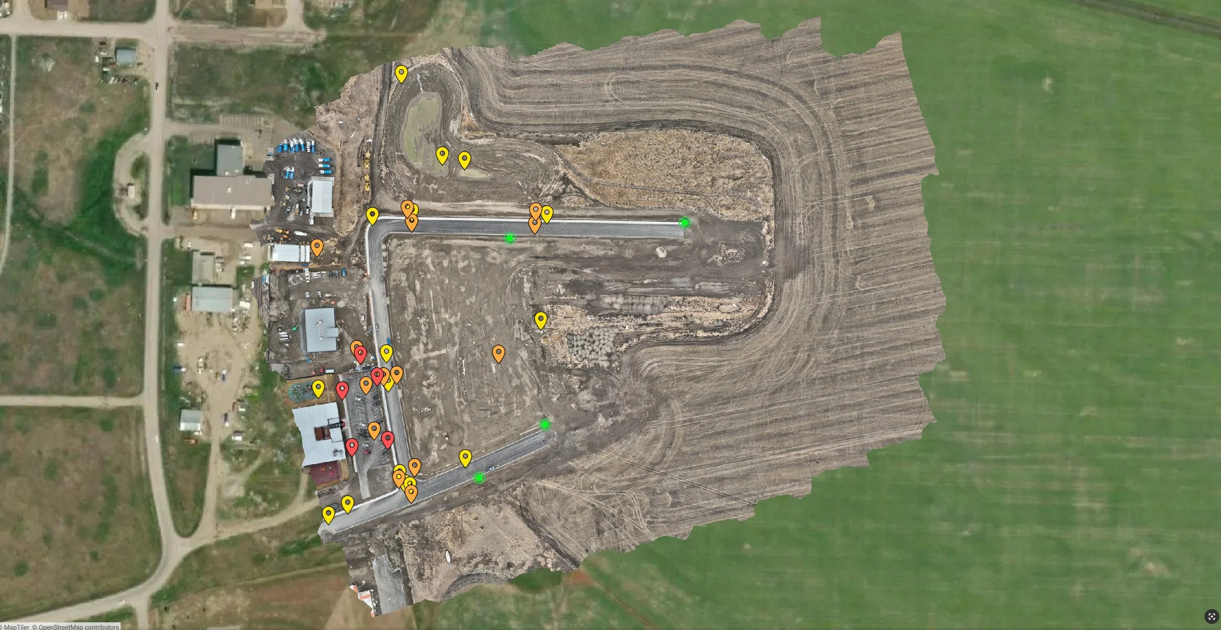
An orthographic map showing locations of deep utility features.
A digital twin model of a future project site.
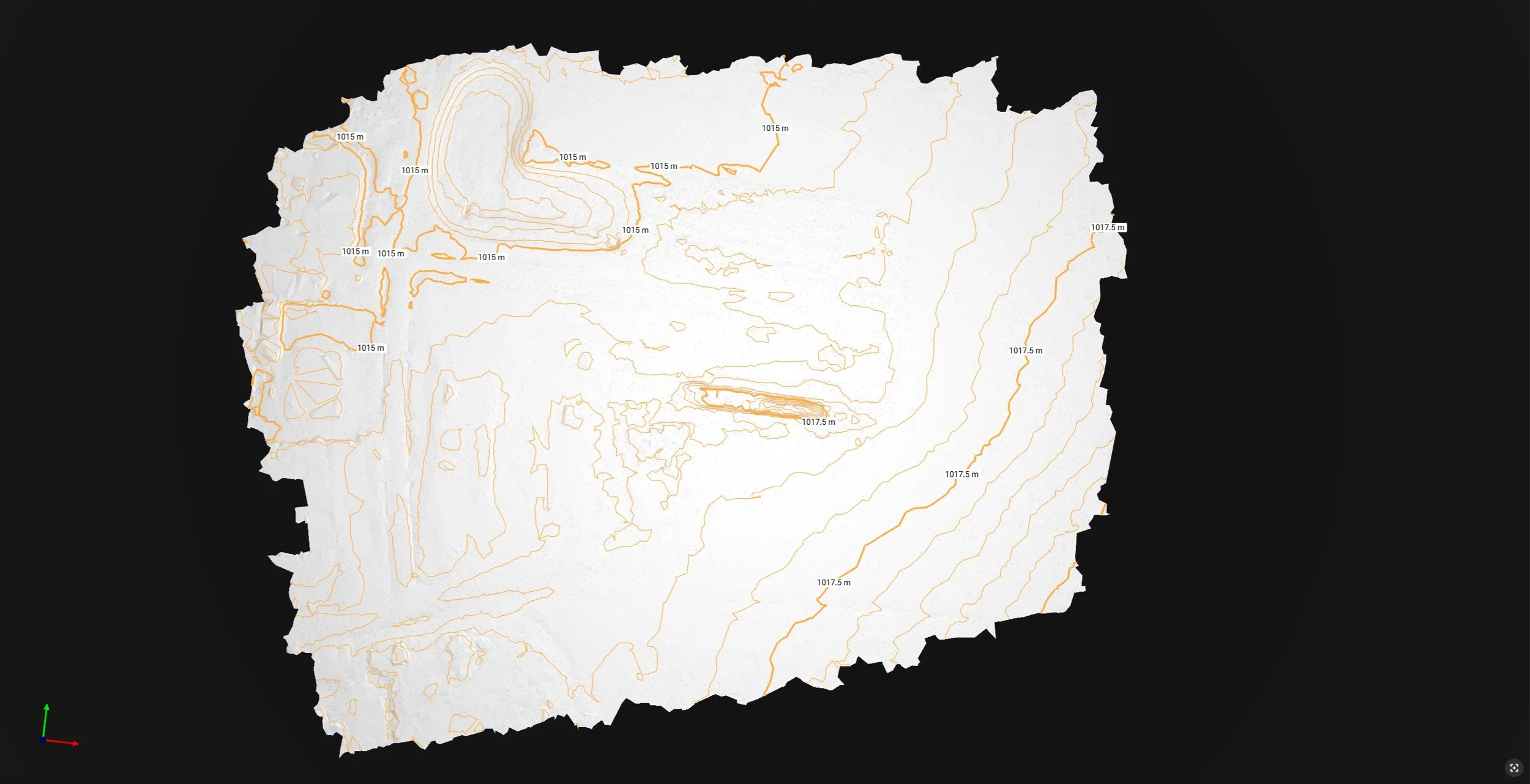
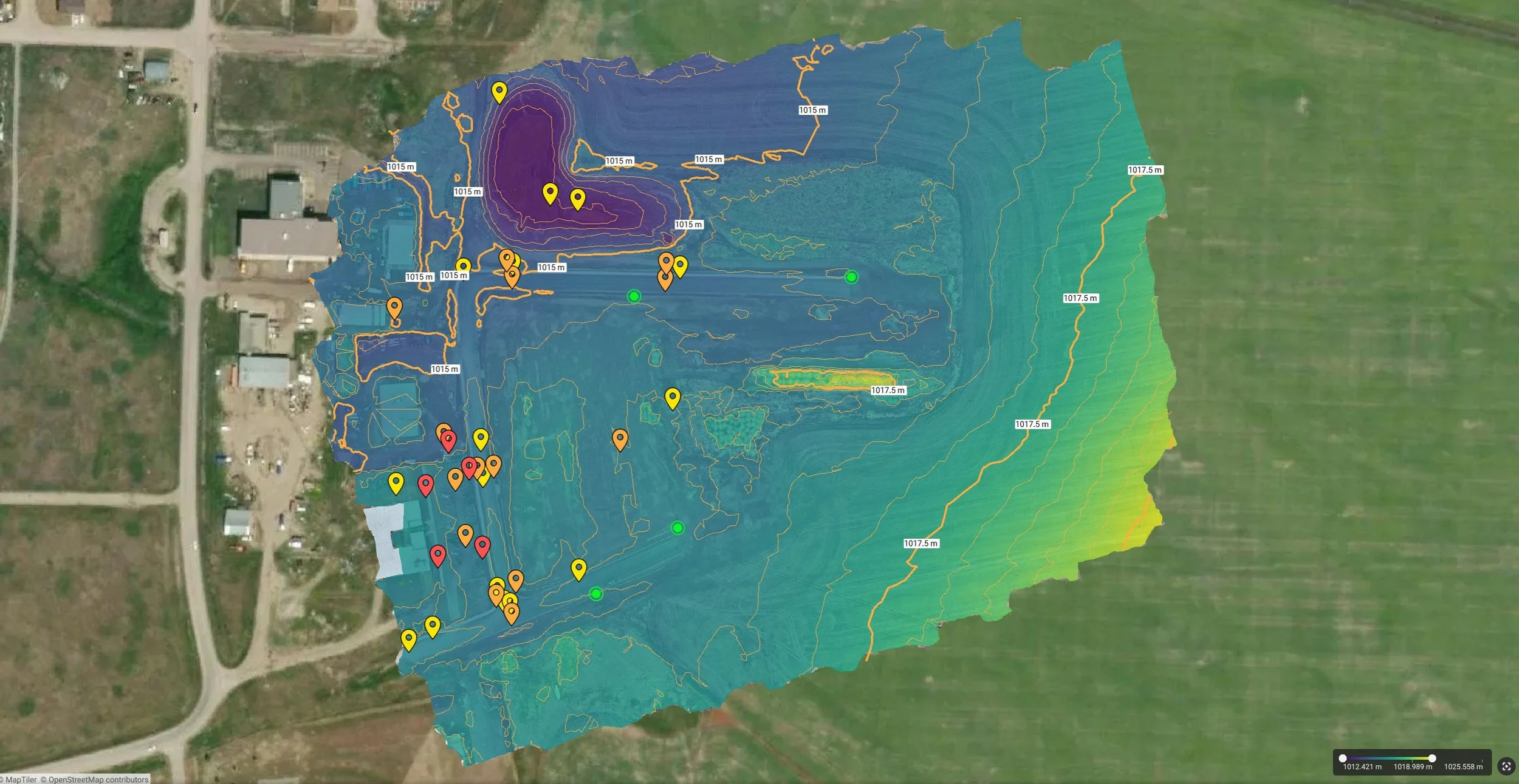
A 2D TIN-surface model with contour-lines showing the topography of a subdivision project.
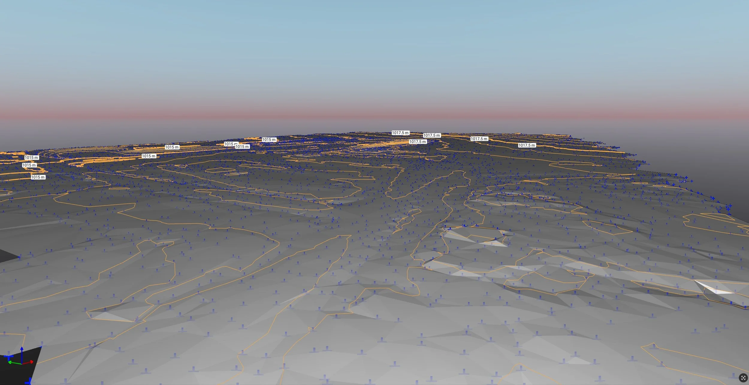
A TIN-surface model in 3D showing contour-lines and topography of a subdivision project.
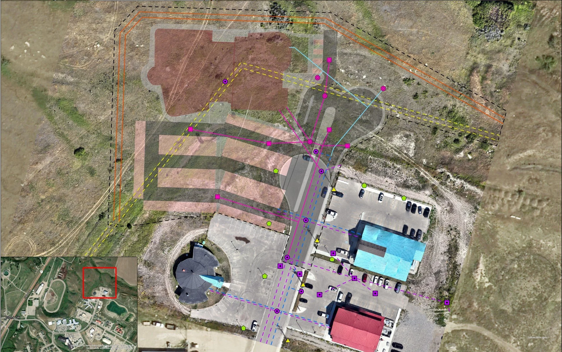
A planning-phase site servicing plan precisely mapped on a current orthographic map.
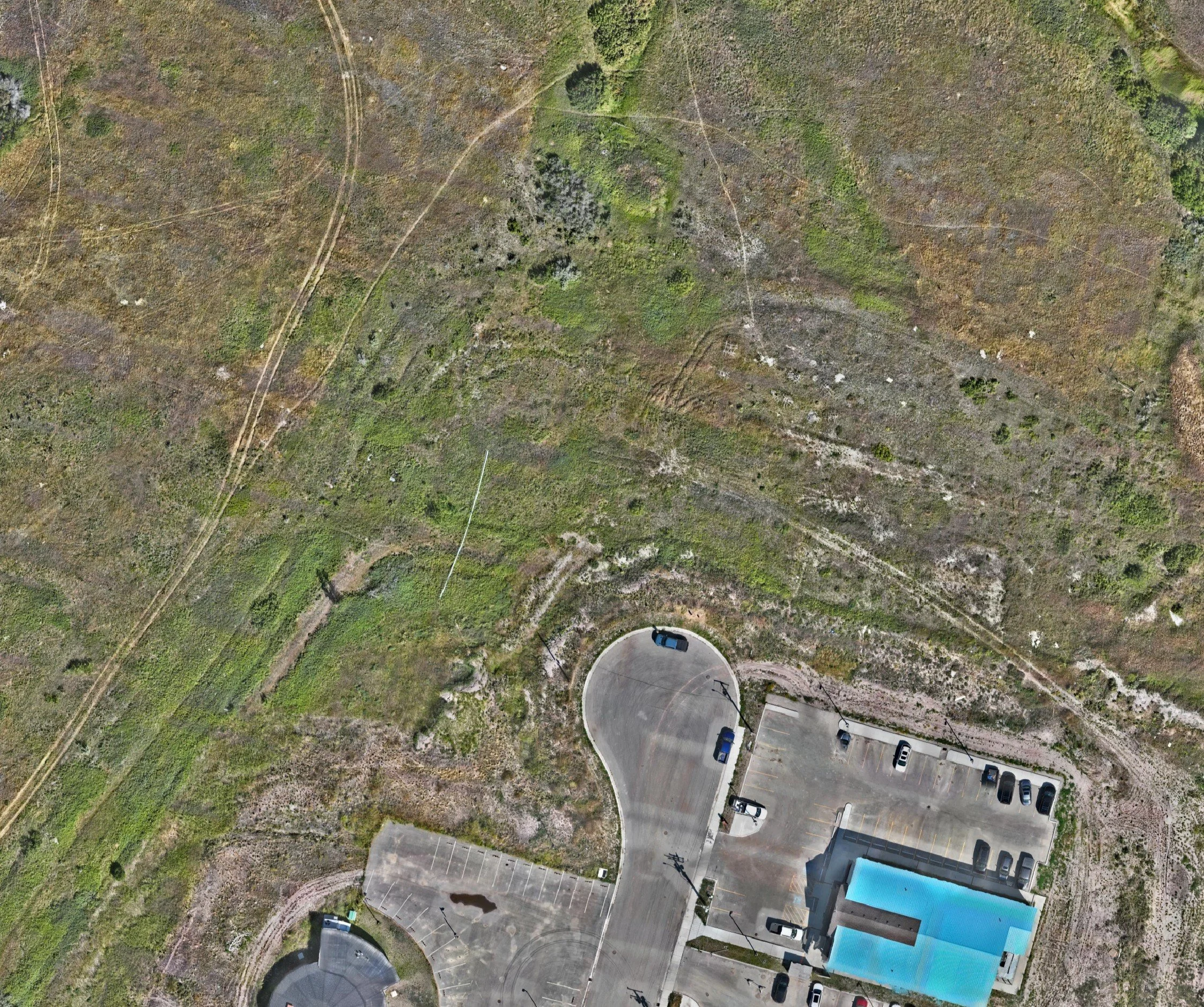
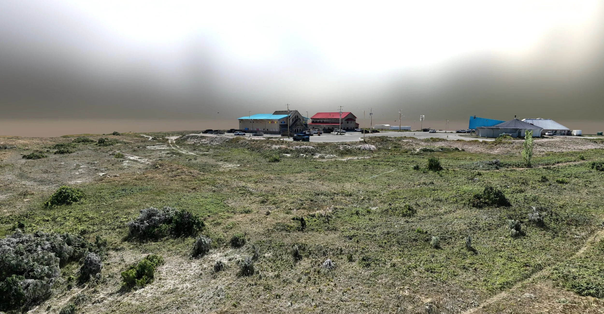
An orthomosaic map of a future project site.
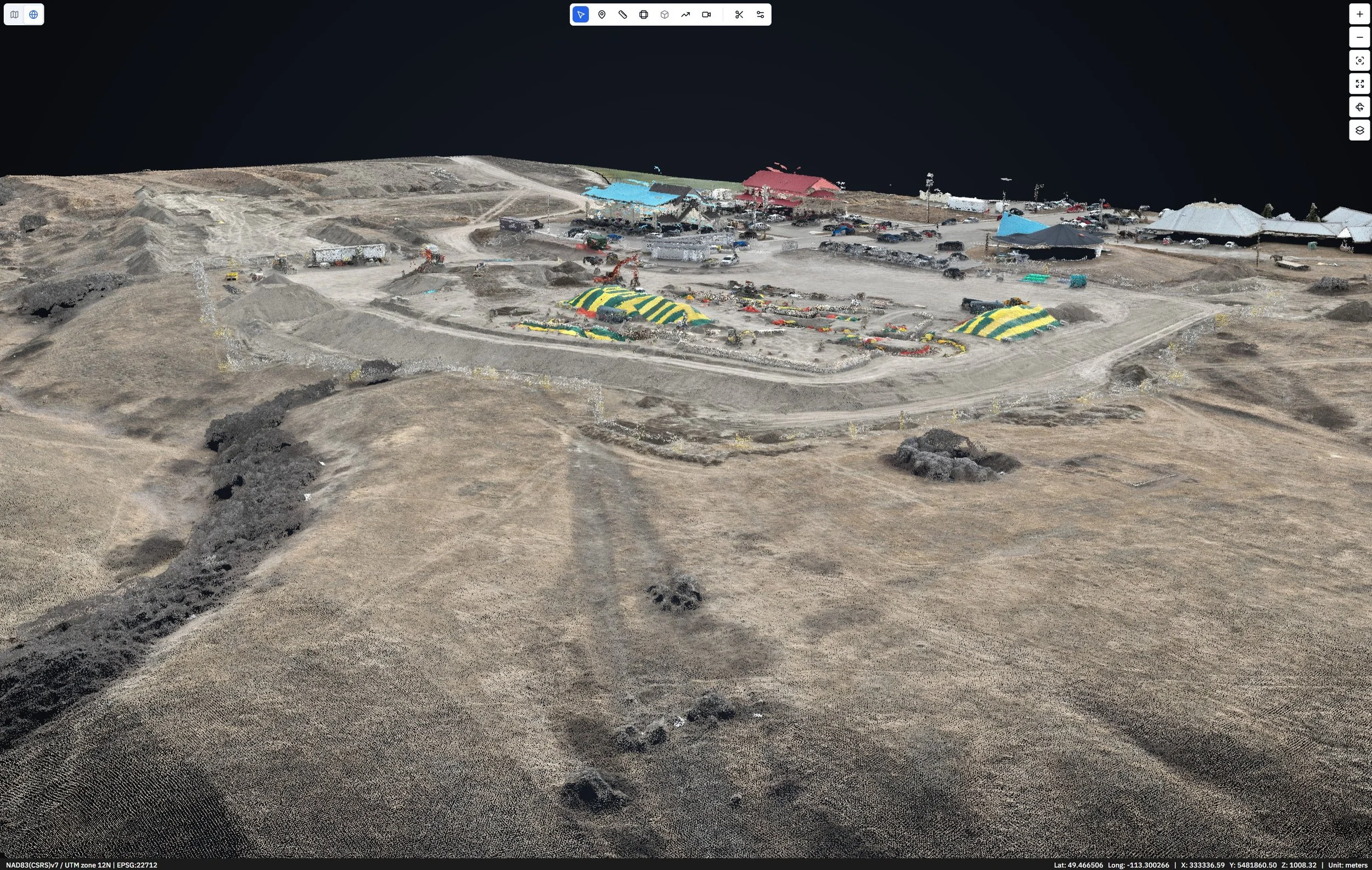
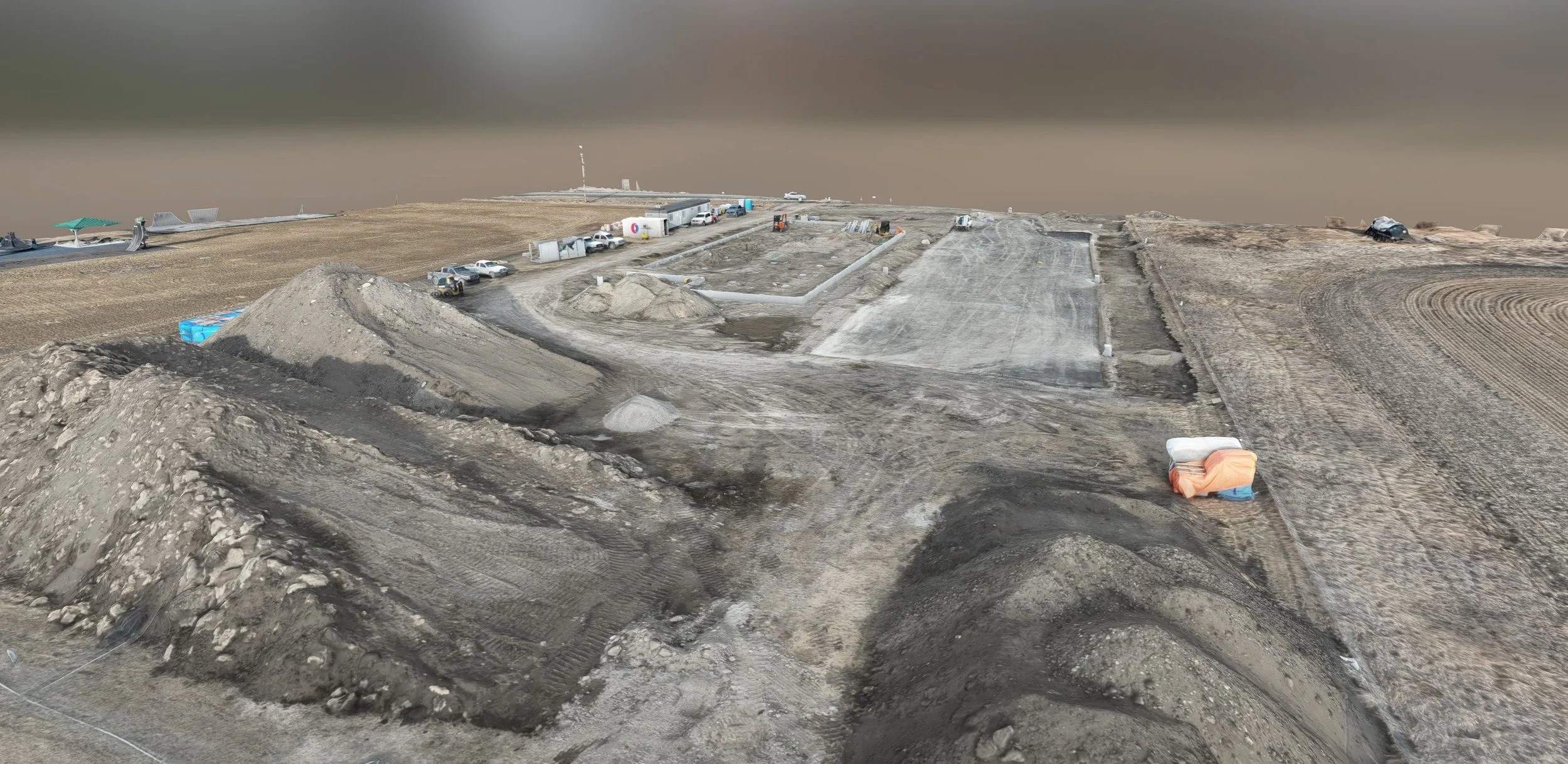
A colorized and classified point cloud model of an active construction site.
A terrain elevation map showing both the locations of deep utility features and contour-lines.
A digital twin model of a project site for monthly reporting use.
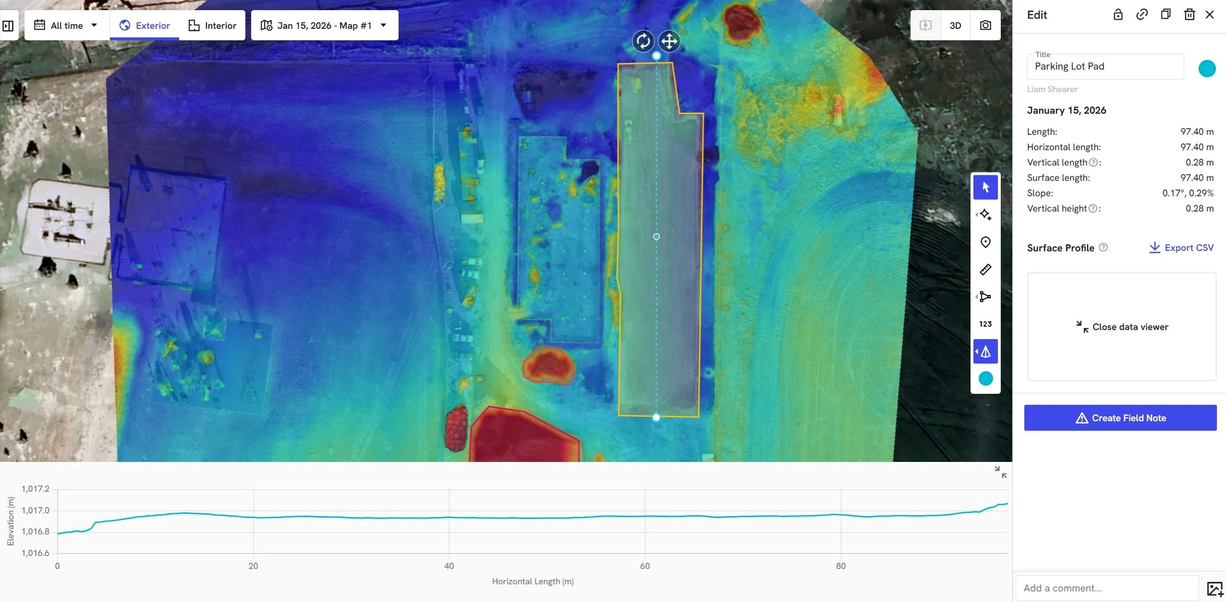
A parking lot surface slope analysis using a 2D elevation cross-section measurement.
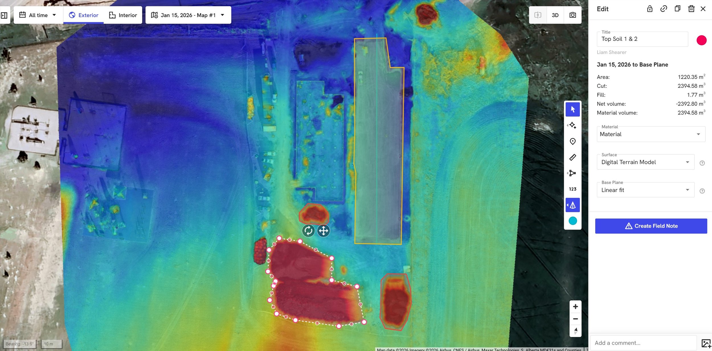
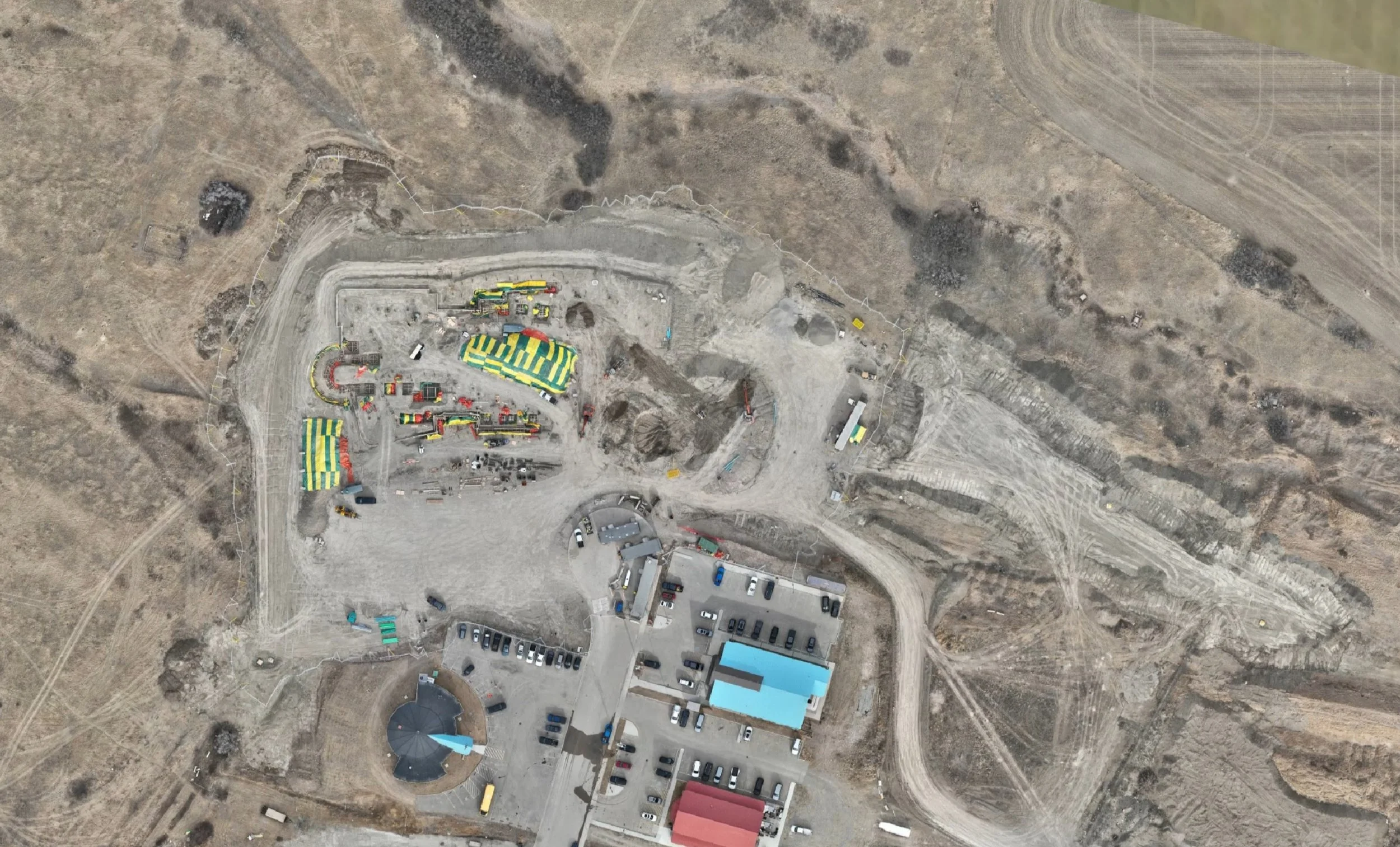
A stockpile analysis at an active project site.
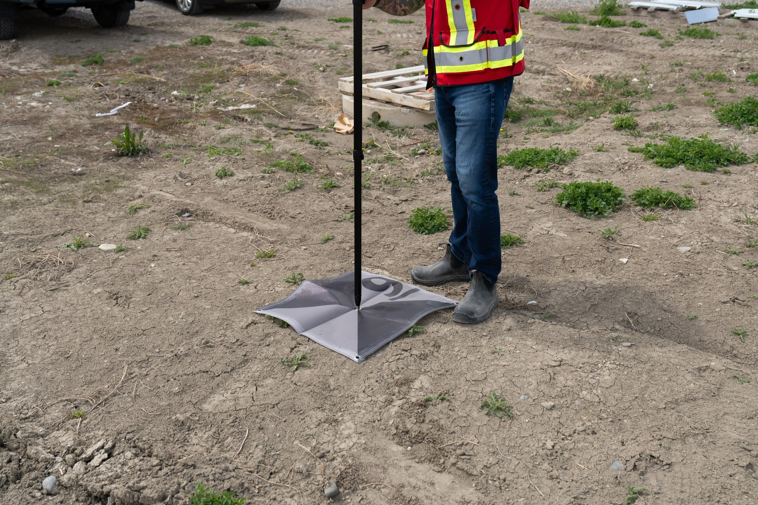
A ground-control target being measured by precise GNSS hardware for use in 'ground truthing' an aerial capture.
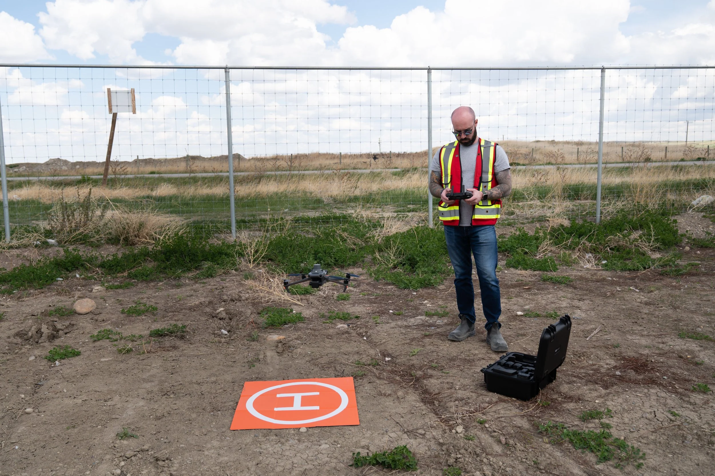
A calibrated RTK drone landing after capturing a 12 hectare construction site.
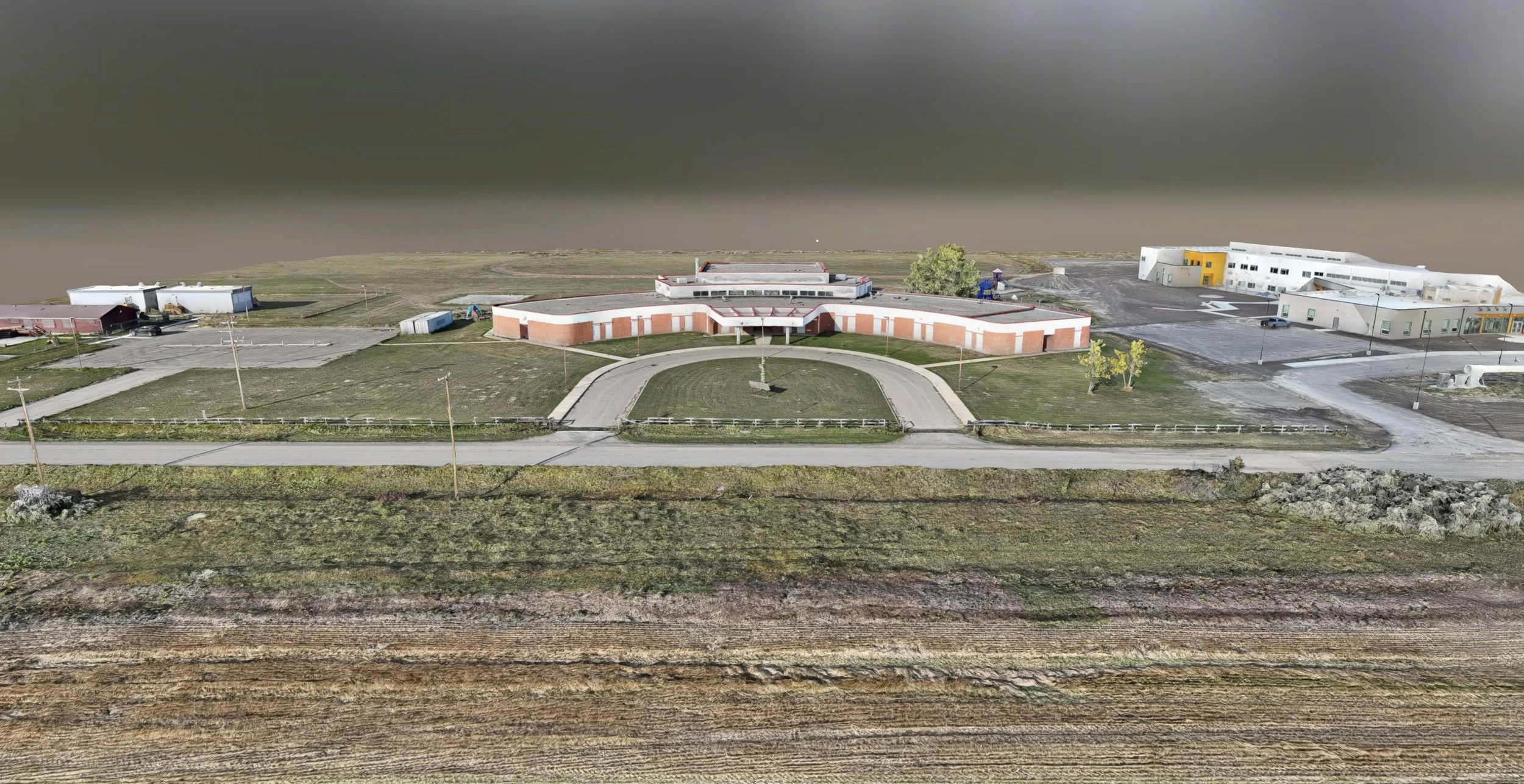
A digital twin model of a building for permanent record before demolition.